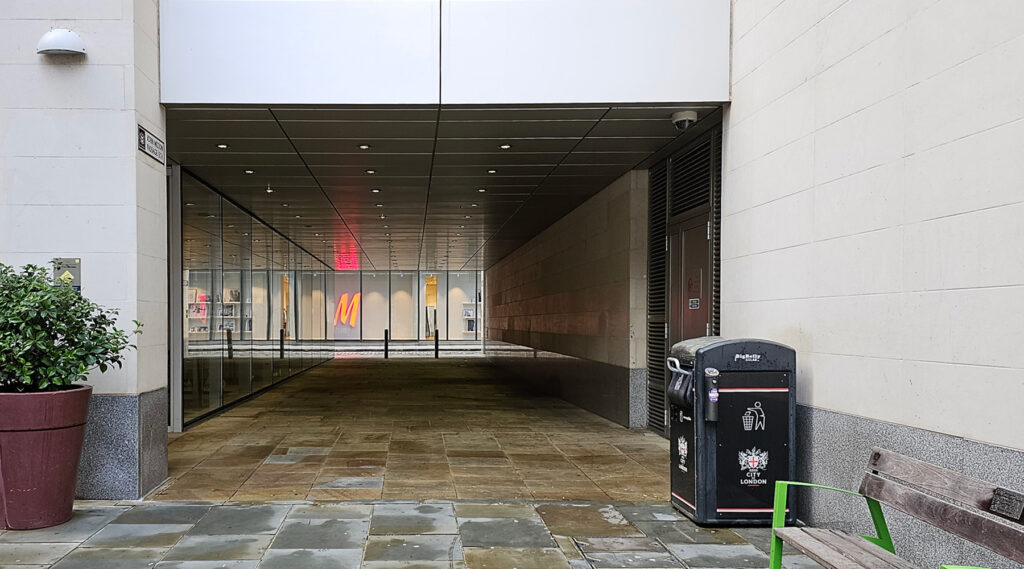
This is a short modern passage near St Paul’s Cathedral, obviously named after the English poet, John Milton, most famous for his 1667 epic, Paradise Lost. The name was chosen because John Milton was born on Bread Street and spent much of his youth living there.
There have been passages leading off Bread Street to the churchyard pretty much since Tudor times, but they changed and moved so often that realistically, it’d be a stretch to claim this new passage has ancient origins, so I am calling it entirely modern.
Over the previous centuries though, the area was dominated by the same sorts of small houses and yards that was commonplace across most of the City of London. The whole area was then flattened during WWII, leaving this part of London in ruins, and that saw the cluster of smaller buildings replaced with the large office block, Bow Bells House, facing onto Bread Street.
Bread Street itself owes its origins, unsurprisingly, to the sale of bread. In the 13th century, the City of London imposed the Assize of Bread to control prices and quality in the City and also banned sales by anyone who wasn’t a Freeman. A bad bread seller could find themselves being hauled through the area on a cart with the offending loaf hung around their neck.
One of the more interesting buildings that was on Bread Street, roughly where the alley is today, was the Bread Street Compter — an early prison for debtors, and was here until it closed in 1555, with the debtors moved to nearby Wood Street.
The historian John Stow, wrote in 1598, that “on the west side of Bread Street amongst divers fair and large houses for merchants and fair inns for passengers had they one prison house pertaining to the Sheriffs of London”
John Stow says that the prison closed in 1555, because the prison keeper, Richard Husband, was so cruel and corrupt, even by the standards of the time, that the City of London tried to fire him. However, finding that he owned the lease on the prison and couldn’t be sacked — they moved the prisoners to a new site on Wood Street – ruining the corrupt prison keeper’s income.
The post-WWII rebuild, of a large office with a stone ground floor and brick upper levels, included a new passageway through the ground floor linking Bread Street to Bow Churchyard, but as far as I can tell, was never named. The building was notable, for the car park that all 1950s offices came with at the time – because it was an early adopter of the Carpack, that allows cars to be more tightly packed together.
The passage was a bit further to the south but was moved to its current location when a new office block was proposed for the site to allow for the central supporting core to be more suitably located in the building. The current version of Bow Bells House was completed in December 2007 to a design by David Walker Architects and HOK International for Mitsubishi as a commercial development.
Then, a few months after the new building was completed, to mark the Quadreicentenary of John Milton’s birth on 14th July 2008, the Lord Mayor of London formally opened John Milton Passage.
Whether they chose 14th July, which is also Bastille Day, deliberately to recognise Milton’s impact on the French Revolution, or because it was simply the only day in a busy Lord Mayor’s diary is unknown.
They know that John Milton was born at the sign of the Spread Eagle, but not the house number where he lived, so the classic City of London heritage tile that the Lord Mayor unveiled simply says he was born in Bread Street, rather than the more usual “near this spot on Bread Street”.
The passage is frankly, a bit bland, being a metal and glass-lined wide space that links the churchyard to the road and then onto the shopping centre.
One of the quirks of the passage is that it’s owned by the office block, and while the planning approval requires that it be open and freely available to use, they are allowed to close it one day a year in order to “prevent public rights of way or common rights coming into being”.
It’d be fun to turn the annual reopening into a ceremony with the Lord Mayor and Aldermen in robes presiding.


Several of the streets in the area are named after the itemssold there in past tiems – Milk Street, Honey Lane, Friday St (fish). It’s because Cheapside was the main market area.
Nice Carpack film – I saw the remains of a similar system off Queen Victoria Street 20 years ago. The wheeled trolleys were attached by grippers to cables in the floor – that’s what determined which ones moved.