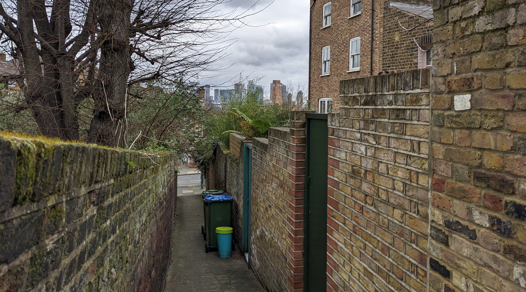
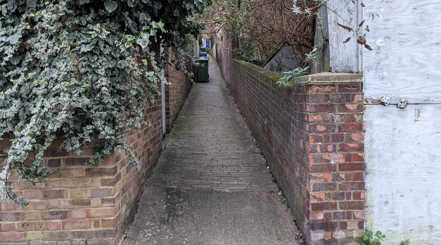
This is a very narrow and steep alley in the side streets of Greenwich, which was longer and steeper than it is today.
The alley came into existence with the development of the area from fields into housing in the early 1850s running behind a long row of houses from Maidenstone Hill at the south to the now lost Atlas Street at the northern end.
The earliest written reference I can find to the alley is from 1853, in a complaint about the “filthy state” of Pigsyte-alley in a vestry meeting.
The road at the southern end is called Maidenstone Hill, in part because this is a very hilly part of Greenwich, but also because there was evidence of an old stone circle a couple of streets to the south in a field called The Point – which incidentally has marvellous views across London.
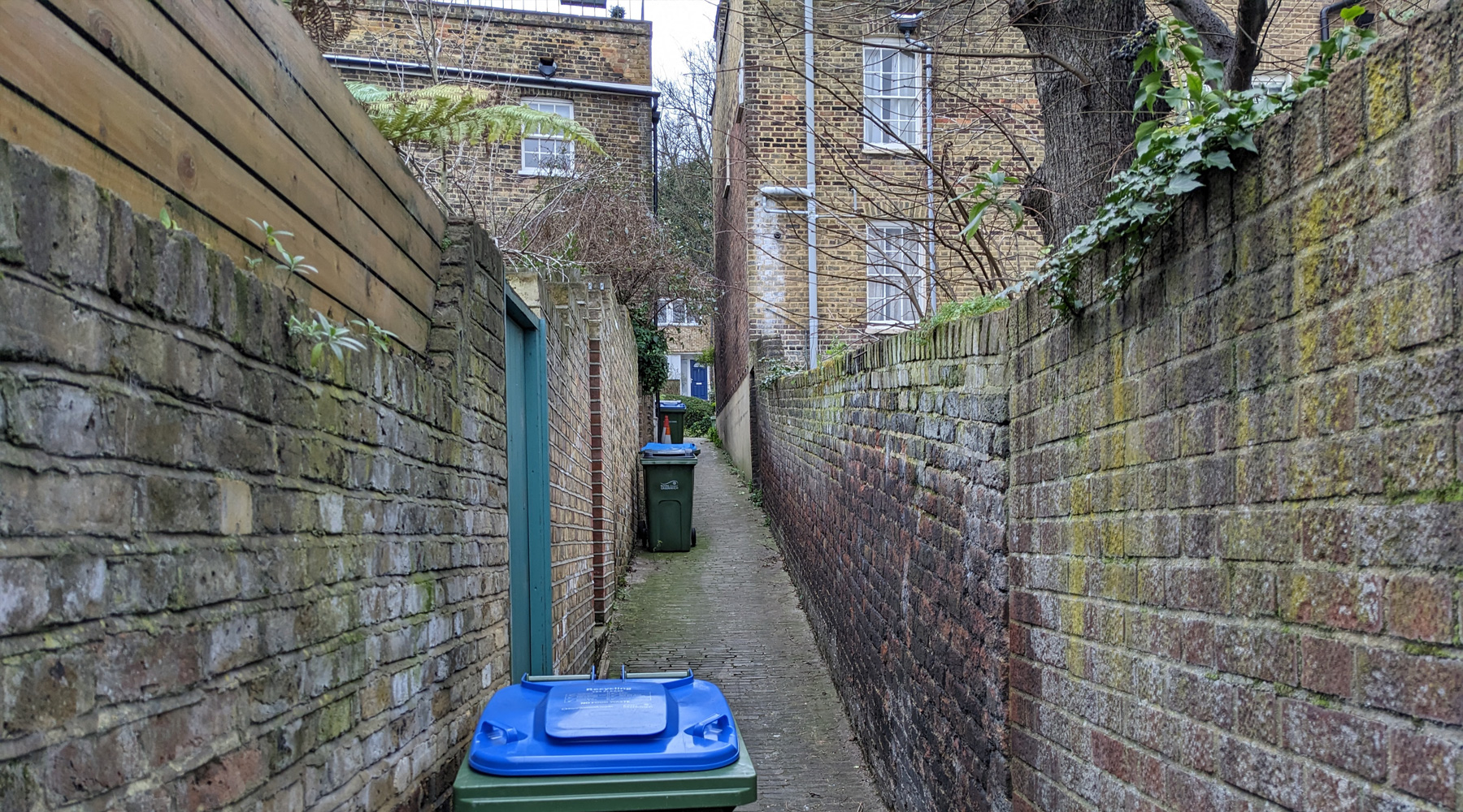
The alley slips between two houses and runs down the back of the houses facing Point Hill on a very steep slope.
If starting at the southern end, at the top of the hill, you might notice some odd looking protrusions in the walls of the Victorian houses. These are part of the Schrijver damp proofing system, which depending on who you speak to, is either a really clever way of reducing dampness in old houses — or is a complete load of old cobblers that has no effect at all and is a waste of money.

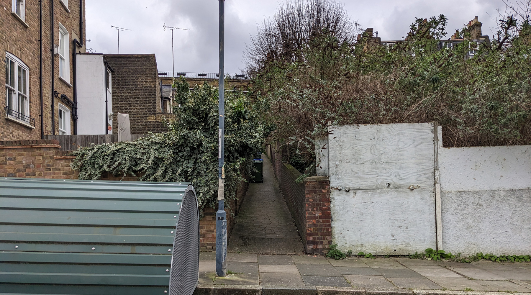
On either side are the back gardens of the houses until you get to the northern end of the alley, where the house appears to be missing. All that’s here is a very overgrown plot of land and fencing that’s falling down and in disrepair. It wasn’t always like that – as it shows up in Google Earth’s historical archive as being a courtyard leading to a row of garages at the rear in 2005, was blocked off by at least 2008, but by 2012 the trees were taking over and it’s been overgrown ever since.
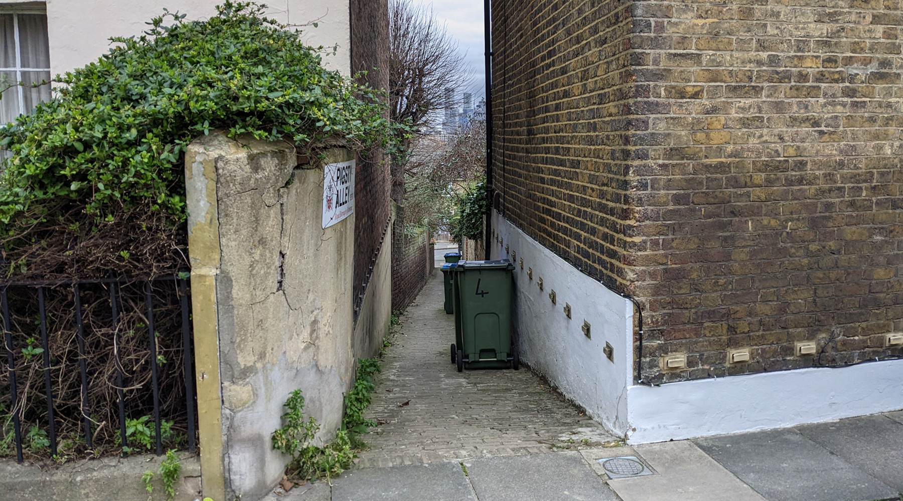
It’s here though that the alley stops, but it used to carry on across the street.
It was post-war clearances that saw the alley cut back to its current length, with the northern half of the alley eliminated when the housing it ran behind was demolished to build modern houses and a couple of blocks of flats.
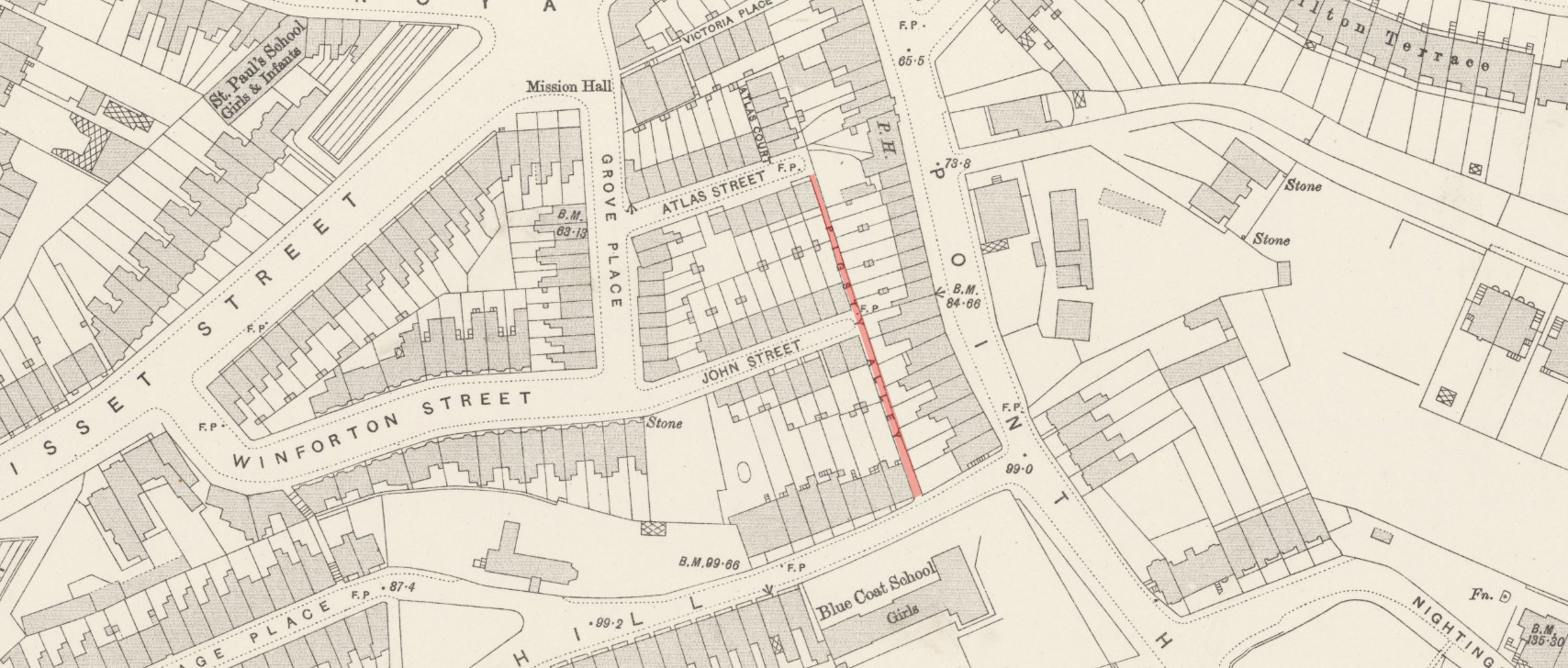
OS Map 1895 – showing original length of Pigsty Alley
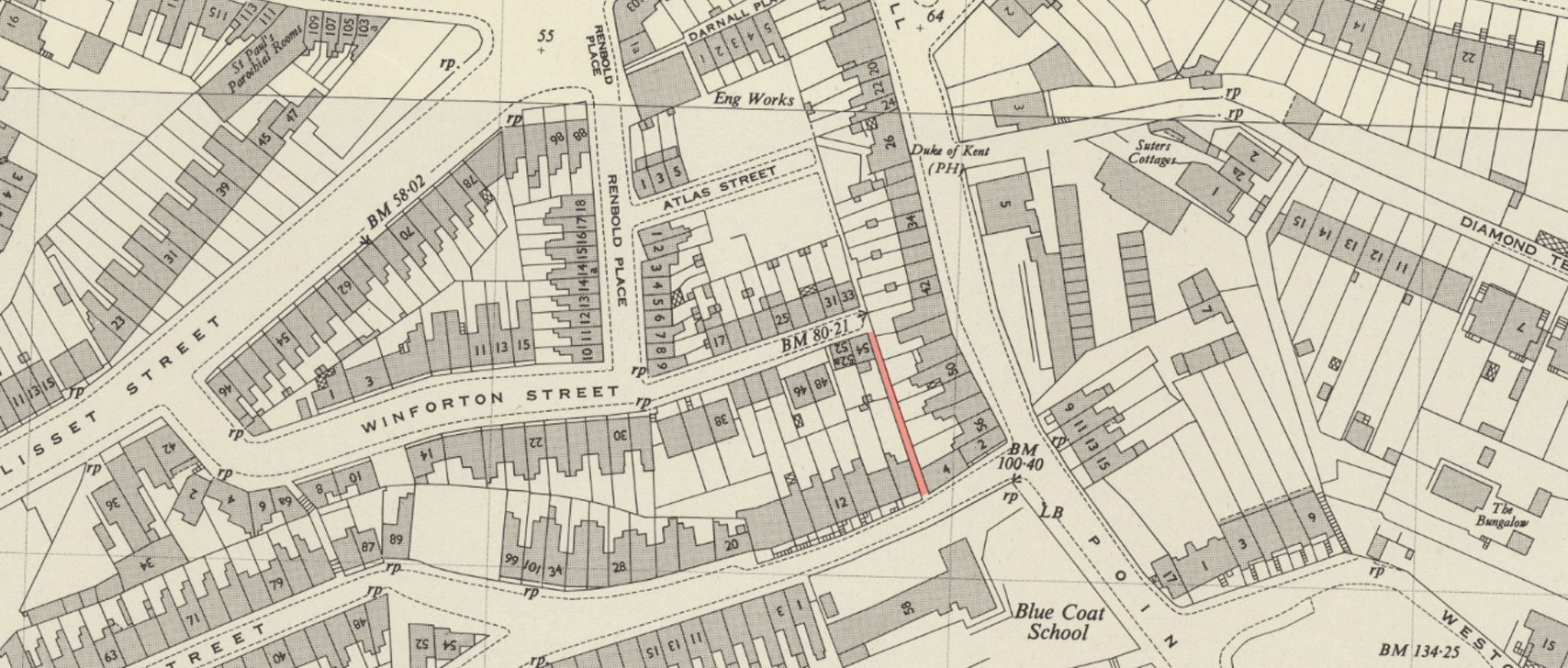
OS Map 1952 – showing alley length as it is today
For that we can partly blame WW2, as two bombs landed here, flattening a large number of houses, which was still a derelict wasteland in the mid-1950s. It was then that the area around the bomb site was cleared of its surviving Victorian housing and modern social housing was constructed, including two tower blocks.
A number of roads were cleared to create the new open space for the towers, as was the northern half of Pigsty Alley.
When choosing the names for the tower blocks, the council decided to name them after the demolished alleys and streets — but opted for Renbold Place and Darnell Place – giving us Renbold House and Darnall House.
Pigsty Alley was sadly rejected – and no one got the chance of living in Pigsty House.
So it was that housing estate development that eliminated half of the alley, leaving us with this narrow stretch to walk down (or if fit, walk up).
The oddity is the alley’s name. You’d assume that it was an area known for pigsties, but as far as I can find out, there wasn’t a notable pig farm in the area at all. It was mainly arable and market garden produce in the area before the houses arrived.
There’s a vague possibility that as some urban homes would keep a pig in their back gardens (despite laws to ban it) that this triggered the name, but if so, why was this alley singled out for the name, when so many others could have as well? The only other example I could find in London was Forest Side in Wanstead, which had the nickname of Pigstye Alley in the early 20th century.
That the alley was noted in 1853 for the filthy state it was in may add credence to the keeping of pigs in the back gardens though as there’s manure to get rid of.
It’s all a bit of a mystery, but one that has delivered a wonderful name for an alley.


Wow, that’s an amazing. That’s a new one for me despite having lived in the area for over 30 years!!!
*story
Hello
Interested to read the Pigsty Alley article. I am a resident of Maidenstone Hill, and managed to persuade the Council to put up the Pigsty Alley signs, although the first ones were stolen. The alley first appears on a map dated 1819; the area between the alley and Point Hill was first partly developed in the mid 18th century, then completely around 1800 – 1815, partly demolished and redeveloped in the 1870s and then as you say in the mid 1950s. I’ve never heard of a stone circle at The Point, always assumed it to be an urban myth, but if you have any evidence please let me know. I’ve done a lot of research into the history of the area, so if you need anything else, give me a shout