A beautifully designed poster map of London’s railways has been updated to add a new station that recently opened, and one that will be opening soon.
(c) Mike Hall
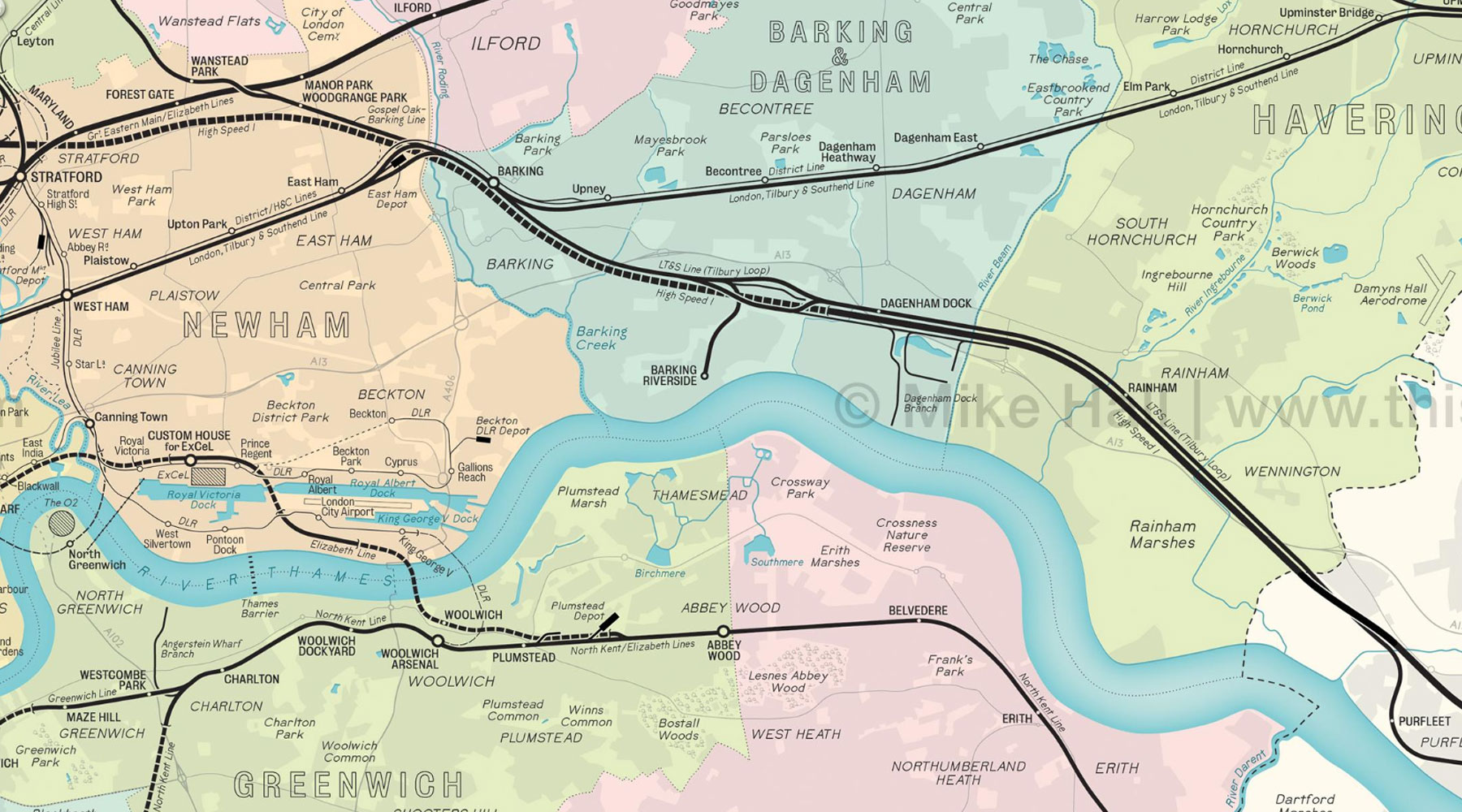
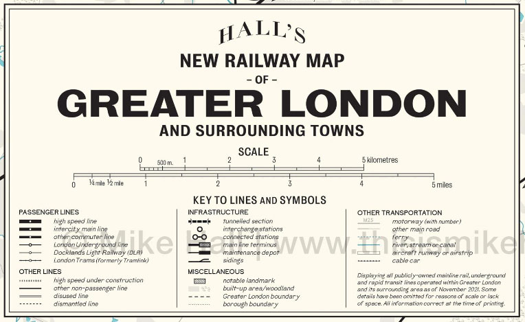
This unique map of the present-day railway network in Greater London is an original, digitally-rendered design that takes its inspiration from vintage maps. It displays the courses of all surface and subsurface lines and the locations of all stations, as well as key infrastructural detail such as maintenance depots and new lines under construction, as of 2022.
The two new stations that have been added are the recently opened Barking Riverside, and the soon to be opened Brent Cross West.
The map is designed by Mike Hall, an award-winning freelance illustrator and map designer based in Valencia, Spain.
On his map, each type of railway is represented by a variety of stroke widths and styles, graduating from the thickest (high speed lines) to the thinnest (tram and light rail lines), while stations are marked by dots and circles; larger circles represent important interchanges. It’s more appealing than most railway maps as it includes the local landmarks and geographical features such as woods and rivers as well, reminding us that maps of London’s railways can be more than just isolated railway tracks laid on a blank canvas.
The maps are printed to order and are available from here.
If you buy one, it’s unlikely that it’ll need updating again for a very long time. Assuming the moribund Beam Park station doesn’t open, then the next update is likely to be when Old Oak Common opens.
(c) Mike Hall


I much prefer https://cartometro.com/cartes/metro-tram-london for accuracy and history.
That is the most beautiful map!
Thanks for the nice write-up, Ian!
Mike
I wish this can be produced leaflet-size en masse to be sold at bookstores cheaply, that I can buy one to bring it for reference while taking the trains.
I’d consider buying a PDF version – I’ve no use for a paper one. But it does look very nice indeed. Appreciate the information.