When railways, or any large hole for that matter, is dug underground, it can often leave telltale marks on the surface.
Subsidence is the usual signature, although these days it is less of an issue as tunneling gets better, and the development of compensation grouting can replace lost soil beneath and stop the surface subsiding a bit.
However, there is also a way of detecting sub-surface works when they run under parks as they can affect the growth of plants on the surface. Even grass can show signs of a subterranean structure if it is close enough to affect plants access to water during a hot summer.
A few years ago when researching something different I came across a photo of Parliament Square that showed very clearly the effects of a subterranean railway running underneath it. I lost the document, but a recent update of Google satellite photos shows the same effect.
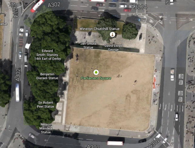
That broad strip running diagonally through Parliament Square is in fact the Circle/District line, and you can clearly see how nearly 150 years after its construction, it is still affecting how plants grow above its brick arches.
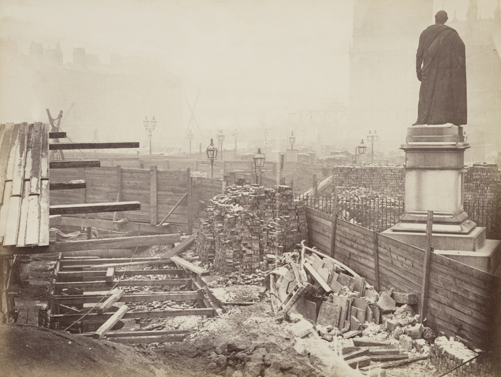


shows how much Parliament Square has ‘shrunk’ since 1895.
Parliament Square didn’t exist until the 1860s though — it was run-down housing before then.
Okay, link to 1895 OS map has taken over the whole text – I wasn’t suggesting that the District was built in 1895!