The Boris Bikes are coming to the Isle of Dogs and in doing so, showing up the fallacy of using walking/cycling distance indicators that ignore the Thames.
In central London, where bridges are plentiful, then the river is hardly a barrier at all, so a large circle centred on your present location indicating how far you can walk or cycle is reasonably accurate.
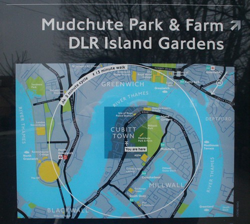
However, once you get past Tower Bridge, the bridges cease, and you are left with just a few intermittent tunnels. As the Boris Bikes also move Eastwards, they are going to start bumping up against the river as an insurmountable barrier – so how will the circular walking distance guide react?
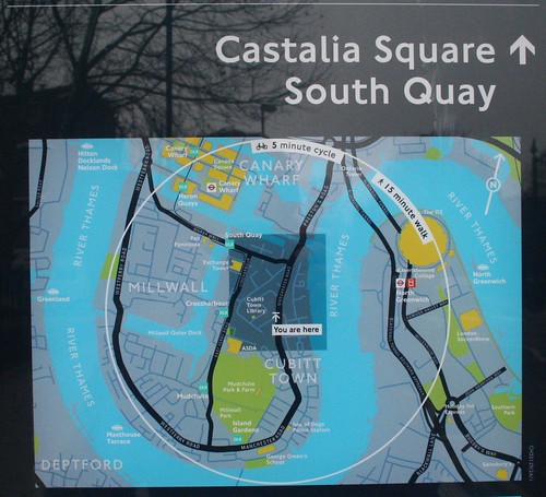
It ignores the river completely.
You can indeed get from Cubitt Town in the Isle of Dogs to North Greenwich on foot, via the Greenwich tunnel – but even the world’s fastest runners couldn’t do it in 15 minutes.
If very fast and incredibly lucky, you just be able to get there if you include the Jubilee line between Canary Wharf and North Greenwich, but of course, you can’t take Boris Bikes on the deep level tube trains.
I’ve noticed the problem with transport websites that seek to recommend local buses ignoring the Thames, which I live next to, and suggesting buses that are, as the feral pigeon flies just a few minutes away, or about half an hour for those of us unable to walk on water.
Disappointing that TfL fell into the same trap, and so visibly.
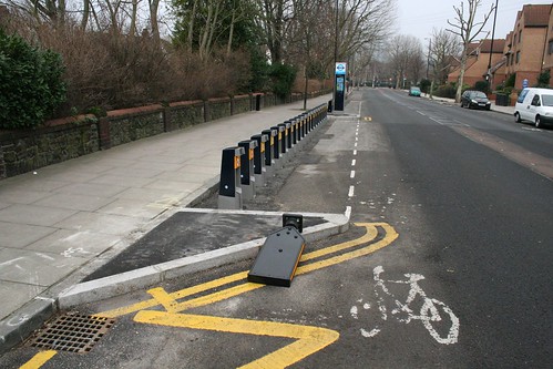
The bike stand has already suffered an accident – as the road traffic warning sign has been hit by a motorist.


Here in Bristol we’ve had those style of maps for a few years – I think we pioneered them in the UK, but I could be wrong there. They have exactly the same fault, showing a walking radius that completely ignores the harbour and river. It gives the worst results close to SS Great Britain, which is about 20 minutes walk from a bridge in either direction.
They do this at the O2 arena as well where the closest hotel recommended is the Radisson , which couldn’t be further from the truth. They don’t mention the river , nor that the Radisson is in Tower Hamlets, and you need to walk up to Canary Wharf to get the Tube across. It’s the nearest but not the quickest , infact some hotels in central London would be quicker.
Does no-one proof these maps? Surely there was one little voice piping up at the meetings, pointing out the fact that walking (and cycling) on water is generally the preserve of only the chosen few? It would take so little extra effort to get it right.
So, that means Londoners cannot walk on the water? What a shame! 😀
As a Londoner who visited Bristol when I wasn’t as fit as I am now, another failing there would be the hills in Bristol. 5 minutes going downhill is a lot further than 5 minutes up!
This is what happens when everything’s computer generated, rather than checked and proofed by a human being. Well spotted 🙂
It’s the first public hint of Boris’ long-term transport plans to freeze the river Thames, allowing easy crossing at any point along the river.
Surely [Baldrick’s] Boris’s next cunning plan is to launch [!] a fleet of Boris Pedalos….