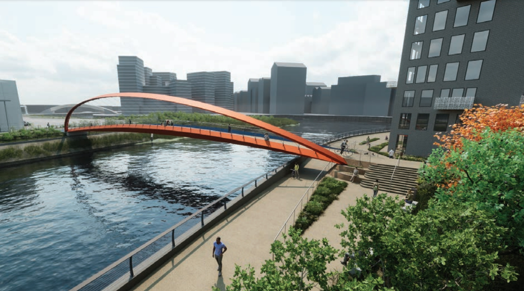
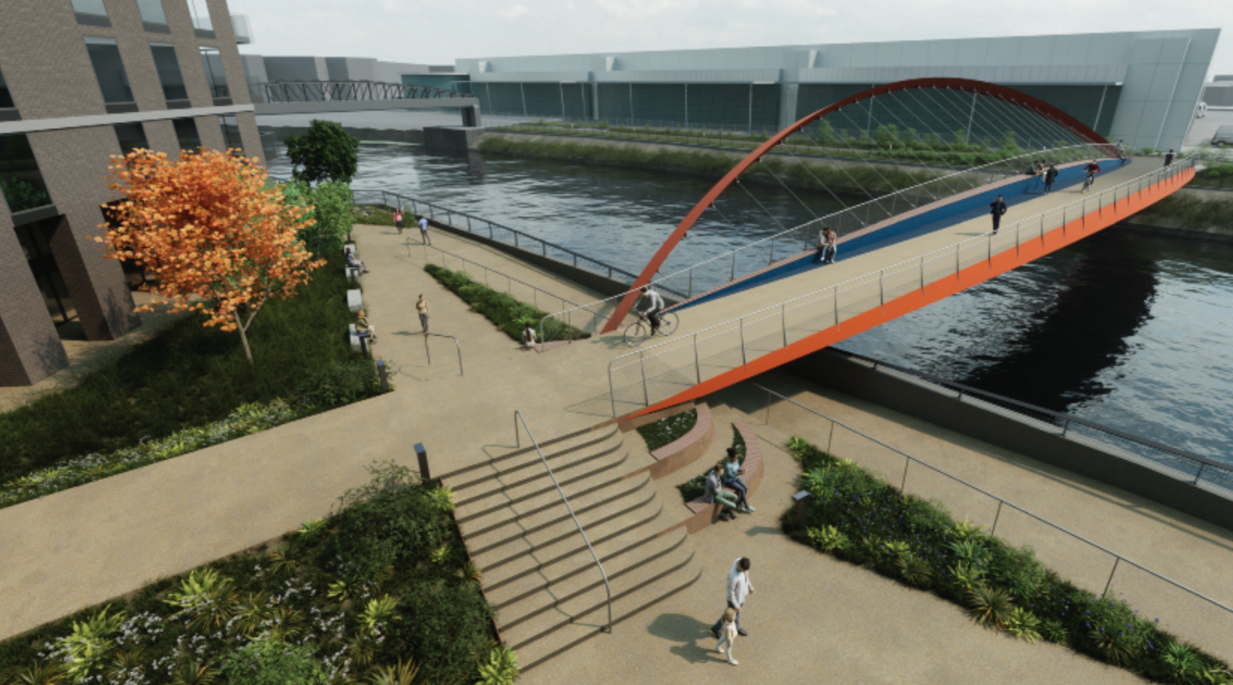
Plans have been put forward for a new cycling and pedestrian bridge to go over the River Lea in east London, filling a 2km gap where there are no river crossings at the moment.
CGI of the new bridge (c) Knight Architects
To be known as the Lochnagar Bridge, it will sit, unsurprisingly, at the end of Lochnagar Street on the Tower Hamlets side of the river, crossing over to Newham, close to the Cody Dock. At the moment, both sides are former industrial plots progressively being redeveloped into housing, and the need for a crossing in this part of the river will become more pronounced over time.
As the two nearest crossings are also busy roads, a cycle/pedestrian crossing will likely be more appealing to users.
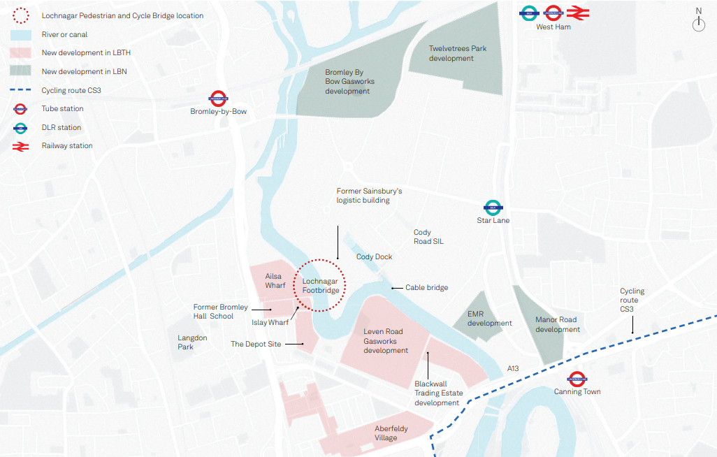
Local area map (c) Knight Architects
The 63-metre span bridge will vary in width from 4.3 metres at the edges to 4.9 metres in the middle – complying with the minimum width of 4 metres set in TfL’s London Cycling Design Standards 2014 guidelines for bridges with shared pedestrian and cyclist use.
One side of the bridge is also designed to have a thicker wall toped with timbers, which can act as a bench for people to sit on.
Due to the difficulty of fitting in a bridge that’s both high enough for boats on the river, but also didn’t have a very long ramp or lift between the pavement and the bridge, they’ve come up with a design that allows the bridge to be lower than the Port of London would usually allow, and then raise the bridge when needed for boats to pass.
The planning documents suggest that the bridge would only be opened in “exceptional occasions”. Those occasional closures are substantially offset by the rest of the time not needing a lift to carry a bike or pram up and down it.
The plans are now up for review by the two councils on either side of the river.
CGI of the new bridge (c) Knight Architects
This might not be the only bridge though, as the council has also identified two other locations for future development, further to the south of the proposed Lochnagar Bridge, at Poplar Rach and Mayer Parry.


It’s great to see some progress with this. The completion of the Leaway (aka the “Fat Walk” post-olympics!) is taking a very very long time.
If you want to see a truly apocalyptic scene go and check out Lochnagar Street on Google Streetview!!
I hope that it will also be possible to re-open the riverside walk south-east of Cody Dock. This will obviously allow walkers & cyclists to avoid the long diversion through the industrial estate, on their way towards Trinity Buoy Wharf and the Thames.
Does anyone have news of this?
Where did you get 4 meters as a width for bi-directional cycling and pedestrian use from? Does not identify this dimension in the document you referred to. The document is only for cycling, not for pedestrians as well.
Bridges are not tracks either as you are hemmed in due to railings and walls, tracks are more open.
Is a 10 year old document relevant for today’s needs?
The source is named in the very same sentence as the 4 metre specifcation is mentioned.