An incredibly detailed map of London’s railways, past and present, has been updated and will be the proverbial catnip to any train or map geek.
Many of you will be familiar with the Carto Metro website, which shows what already seems to be an impressively detailed map of London’s railways, and as useful a tool it is, it pales compared to what TfL employee Joe Brown has managed to produce.
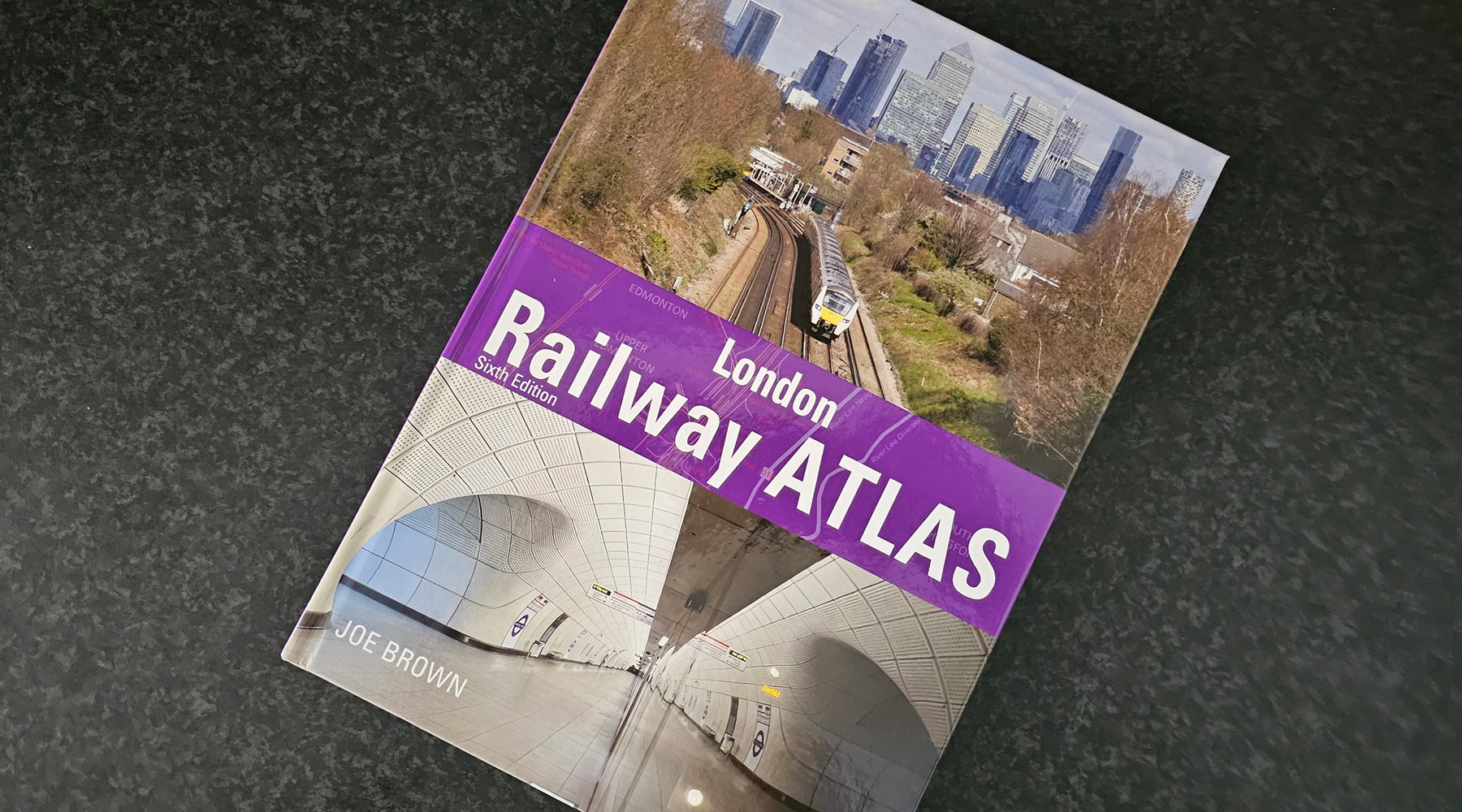
The London Railway Atlas is now in its 6th edition, in part as what was a hobby morphed into a serious publication and needed cosmetic improvements over previous editions — and to sate train geeks obsessive attention to detail by supplying corrections where needed.
This latest edition is also a complete redesign, as the previous editions were created using software more used to publishing online, and he has switched to a print-friendly tool to keep the book publisher happy.
That means the sixth edition is a complete refresh as well, with every line redrawn, every I dotted and T freshly crossed. Apart from corrections, additions to this edition include the Elizabeth line and the Northern line extension to Battersea Power Station.
The London atlas has also expanded a bit, nudging slightly beyond the M25 in places, so there’s more this time to look at. A detailed appendix at the back also offers a timeline of the railways represented in the atlas.
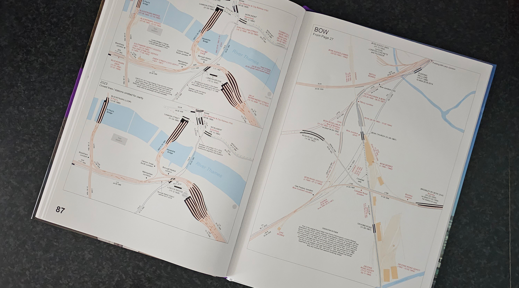
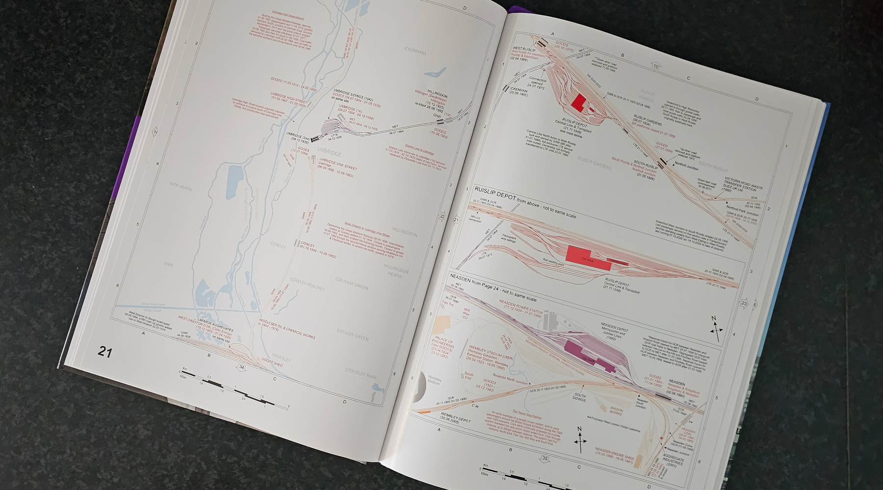
The atlas shows how the railways look today, but so much more impressive is the depth of historical detail that shows how much larger the railway network used to be. That scale of the older network is mainly due to freight, thanks to the vast numbers of goods depots and sidings that were all over the place.
Those depots are now mostly lost under housing and offices — or the British Library — but the atlas lets you see the scale of the operation that the cargo-carrying railway used to provide.
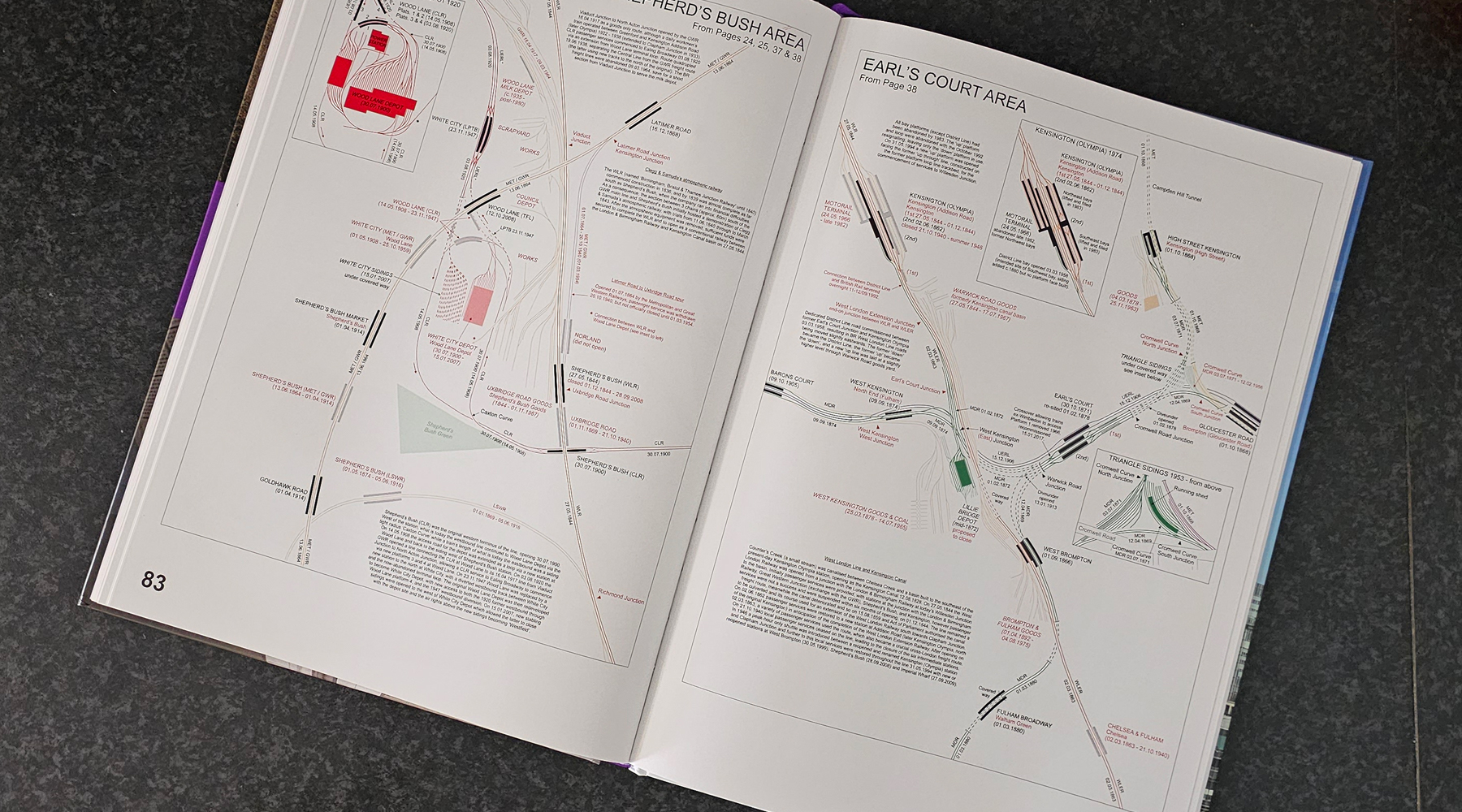
I’ve previously noticed how railways are like arteries for the country, and in places, this atlas almost looks more like a map of the human body with muscles and veins revealed underneath the skin.
A natural constraint of printing so much information in a book format is that the font size is a bit small, which can be a bit of a struggle for us older folk, but the only alternative would have been to make a much larger and more expensive book.
As a book, it’s likely to appeal to anyone with an interest in London, not just the train nerds, adding as it does a fascinating insight into something many of us use daily, but yet where so much of London has been demolished.
The London Railway Atlas – 6th Edition by Joe Brown is available from Amazon, Foyles, Waterstones or direct from the publisher, Crécy.


I received my copy this morning. I’ve had a quick flick through. It looks like another brilliant edition.
Sold to the man in Stratford
I do love a good map!
Over time, and quite by chance, I’d collected all the previous editions and was eagerly looking forward to this one: and I was not disappointed!
I hope that Joe Brown is spared to bring us many further editions!
I assume that the maps cover all of the Underground network, but how far out do the maps go on the Chiltern Line? Thanks for any information.
To sate and for the sake of language geeks, this may need editing: “to sake train geeks”?
Great to see Tubeman still doing his thing from back in the day!