You’ll soon be able to use Google’s street view to remotely wander around several major tube stations just as you can the streets of London.
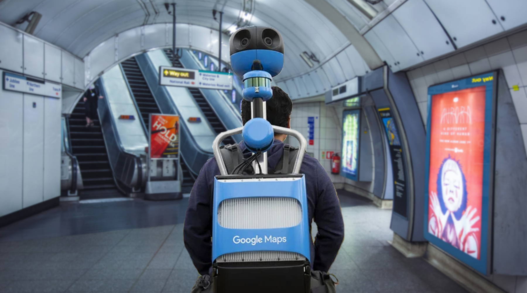
Mock-up image of Google backpack camera operator in a tube station. Google / Unsplash
By showing the routes that people take through some of London’s key stations, Transport for London (TfL) hopes that customers will be able to use Google Street View within stations in the same way they would for journeys made by walking and cycling across London. In particular, TfL hopes this will be beneficial to customers with accessibility needs or people who are unfamiliar with travelling in the capital.
The project will use cameras that capture 360-degree images inside of around thirty tube stations, with the first filming starting in a few weeks time.
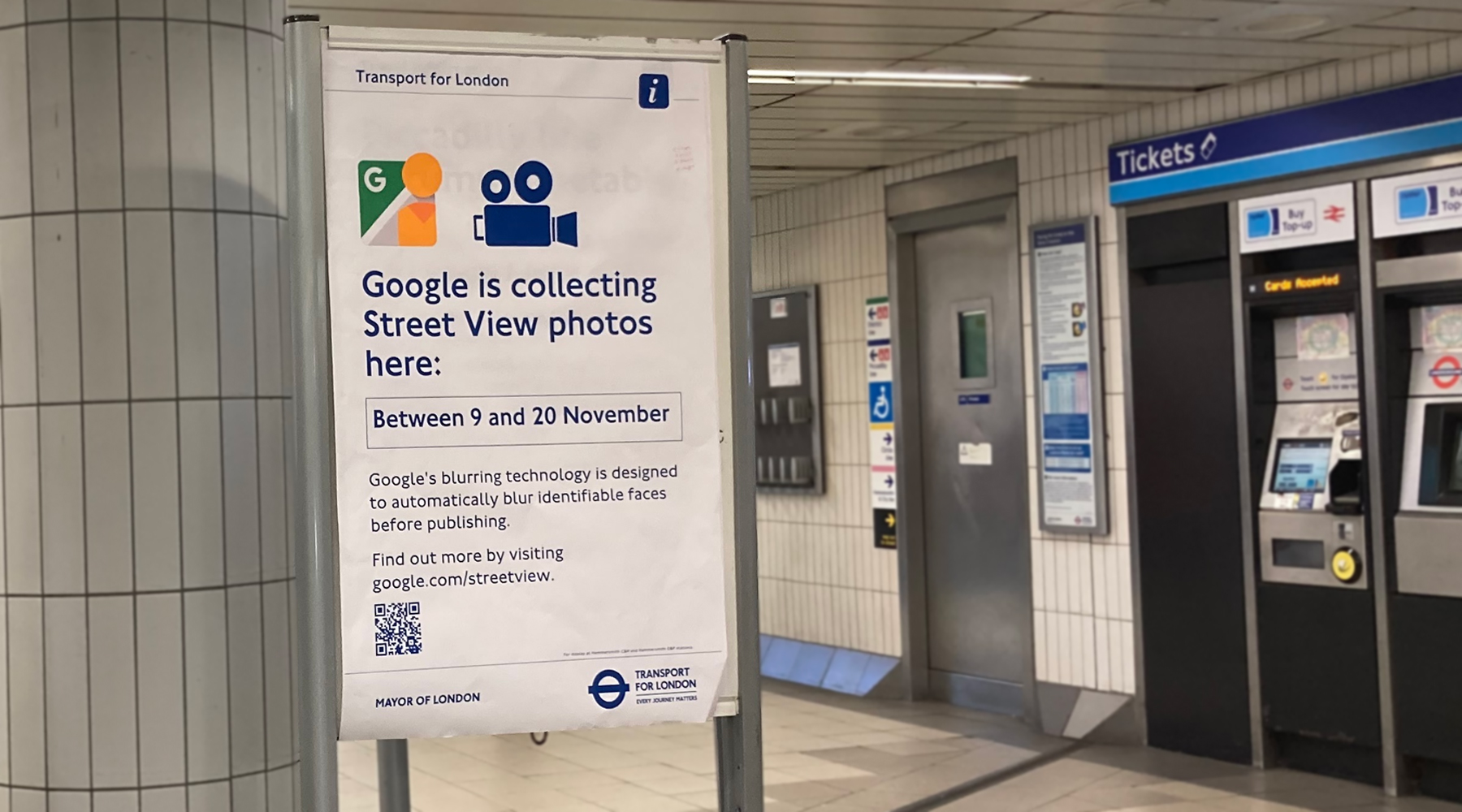
To avoid rush hour crowds, the filming in the stations will only take place between 10am and 4pm, and there will be posters displayed when Google is in a station in case anyone wants to avoid the cameras, or secure eternal fame by tracking down the Google person and making sure you’re in the photos.
(c) TfL
Just like standard Google Street View, the images will be blurred where necessary for privacy.
Deputy Mayor for Transport, Seb Dance, said: “I am delighted we are working with Google to bring Street View to the Tube. This exciting new project will give people the ability to plan their routes on the London Underground in the same way they would when walking and cycling across the city. Introducing Street View will support people to better navigate some of the capital’s busiest stations and help us to build a better, more accessible London for all.”
Under the contract terms between Google and TfL, Google will own the images and any cartography (mapmaking) information captured. At the same time, TfL has the right to require elements to be blurred out in addition to Google’s existing blurring of personal information.
The agreement lasts two years, renewable after that, and Google covers the cost of collecting the images at no cost to TfL.
The stations that will be street-viewed first are:
- Baker Street
- Bank/ Monument
- Bond Street
- Camden Town
- Canada Water
- Canary Wharf
- Canning Town
- Cannon Street
- Custom House
- Embankment
- Euston
- Euston Square
- Farringdon
- Green Park
- Hammersmith Highbury and Islington
- King’s Cross St. Pancras
- Liverpool Street
- London Bridge
- Moorgate
- Old Street
- Oxford Circus
- Paddington
- South Kensington
- Stratford
- Tottenham Court Road
- Victoria
- Waterloo
- Westminster
- Whitechapel
Some others that could be added later are Heathrow, Southwark and West Hampstead.
Greater Anglia has also been creating virtual tours of its stations, which they provide on their website.


Really good!
Even better would be updated axonometric diagrams/pictures of those stations, now that many ( but especially “Bank” ) have been much rebuilt
At last I might be able to work out how to get out of Kings Cross effectively…. Probably applies to Bank too.
Simple trick – always follow signs to the Euston Road exit when exiting from or changing between deep level lines!
Very good news. If they add street views of platforms, hopefully all platform exit signs will be clearly visible.
It would have been even more interesting if they had included the closed/abandoned areas and stations that we can’t see normally.
Absolutely welcome news, guess I’ll be ditching Apple Maps
… BRILIANT GOOGLE = SUPORT !!!
Technically, this is an incredibly difficult bit of mapping… how do you determine where the images are coming from relative to everything else? There’s no GPS down there, and hall effect sensors for compass direction would have reduced accuracy due to the tunnel rings. You’d need LIDAR for starters, some form of beaconing, Bluetooth or WAP triangulation… accelerometers? You need to capture three dimensional information such as depth underground and heading, all done with a backpack mounted system. You’d not be able to make assumptions about level floors too, so many of these tunnels slope, you need precision level detection. When they do this with 3D topography, they use static LIDAR nodes… If you can map the imagery onto such accurate 3D models, it would work I suppose.
Brave, I’d say!
Surprised they didn’t get unobstructed views by videoing the stations outside of passenger service hours. Most of the stations listed are still quite busy between 10 and 4.
Is there any updates to Google Street view coming to London Underground???