The British Library has released a huge archive of nearly 18,000 maps and views that have been digitised and are available for free – with no copyright restrictions.
The collection of maps are from the Topographical Collection of King George III held by the British Library and captures four centuries of visual impressions of places throughout the world, from maps and atlases to architectural drawings, cartoons and watercolours.
In total, the collection contains 40,000 maps and views, and the British Library plans to make the whole collection available once the rest of it has been digitised.
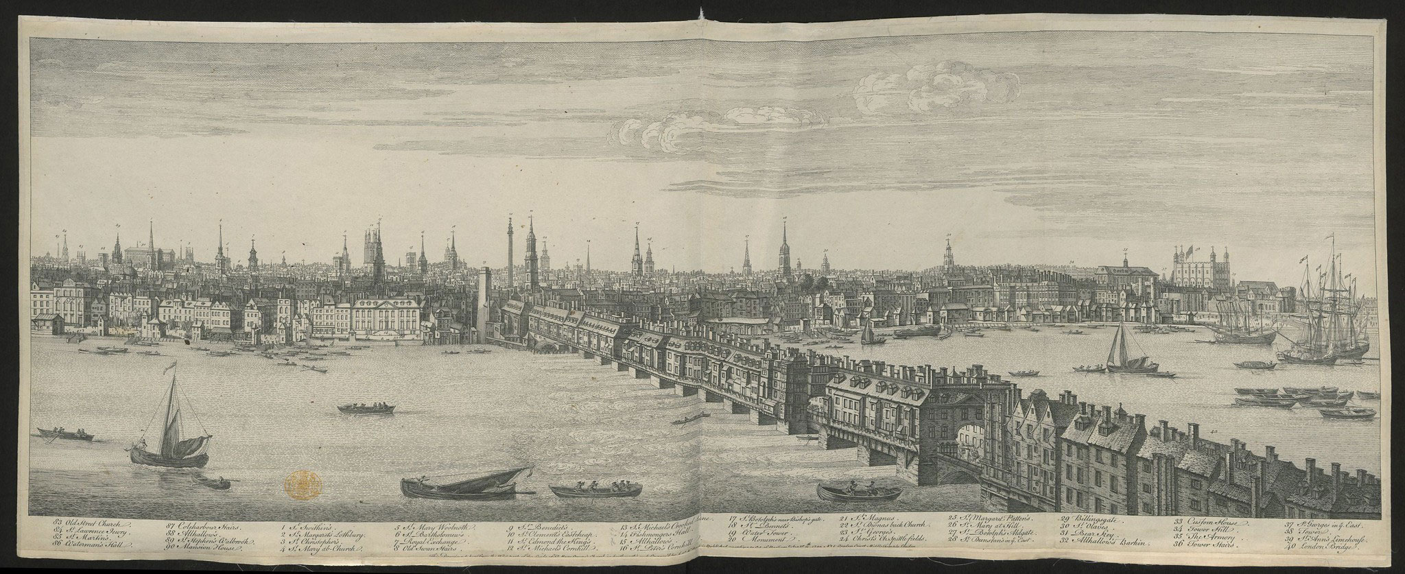
Panoramic view of London: Buck, Nathaniel
Putting the maps online for free is part of a seven-year project to catalogue, conserve and digitise the collection which was presented to the Nation in 1823 by King George IV. The collection is arranged geographically, with around 40% dedicated to the British Isles, one third covering the Europe of the Grand Tour, and 10% for British areas of influence such as North America, the West Indies and India.
The images are available for anyone to view online via the British Library’s digital Flickr Commons collection, alongside over 1 million copyright-free images from the Library’s collection of printed books.
This is the first of two planned image releases.
The maps are also being made available on the British Library’s Georeferencer, an interactive application that allows volunteers to turn maps into data by adding locations to digitised British Library collections, initiating new forms of discovery and research.
The collection is on Flickr here, (example London search) and can be searched for in the Library’s archive here.

FAIRBURN’S PLAN of the Proposed WET-DOCKS AND CUT, from NEW GRAVEL LANE to BLACKWALL.
A number of maps from the collection are also accessible for the public to view in the British Library’s permanent exhibition Treasures of the British Library, including maps of forts in North America by Mary Anne Rocque (1765). The free to visit gallery has recently reopened to the public (booking essential).

An EXACT PLAN of the TOWER of LONDON 1725.


Christmas has come early. Thanks for letting us know about it.
Wonderful! This is the true democracy of education.
Good man – very helpful at the moment for my research.
Brilliant – thanks 😀