Researchers at the University of Bath have been able to use a novel form of satellite monitoring to show where Crossrail tunnels run under central London.
Specifically, the researchers evaluated the potential of using highly detailed satellite monitoring, known as ‘Interferometric synthetic-aperture radar’ (InSAR) techniques to assess building deformations caused by tunnelling under urban areas.
Despite the best efforts of engineers, there will always be some level of subsidence at the surface when a tunnel is dug underneath, as the tunnel lining can never perfectly fill the space left by the tunnel boring machine.
In critical areas counteractive action is taken, such as pumping grout into the ground above tunnels to offset the subsidence, but this is expensive and time consuming. Around £1 billion of Crossrail’s costs went into offsetting the effects of subsidence.

Often the arrival of soil subsidence as the tunnel boring machines (TBM) pass though is monitored by the use of remote lasers mounted close to buildings, with reflective panels dotted around the area, and the data fed automatically to a central office to monitor what effect the TBM deep below ground is having.
Traditional monitoring systems will provide an accurate measurement of building displacements but are typically installed in large numbers only on vulnerable structures. For the majority of building on large scale projects, only few points can be constantly monitored.
Although the potential of satellite based InSAR for monitoring of structures and infrastructure has been extensively proven, only the recent availability of high resolution satellites have theoretically enabled the direct use of InSAR monitoring data.
The used microwave bands are almost free from atmospheric absorption and the radar signal to noise ratio is high enough so that all weather, all time (day and night) imaging should be possible.
It was to prove the theory that the University of Bath got involved, and now, for the first time satellite monitoring has been used to provide data about the effect of tunnelling and soil-structure interaction on the deformation of buildings.
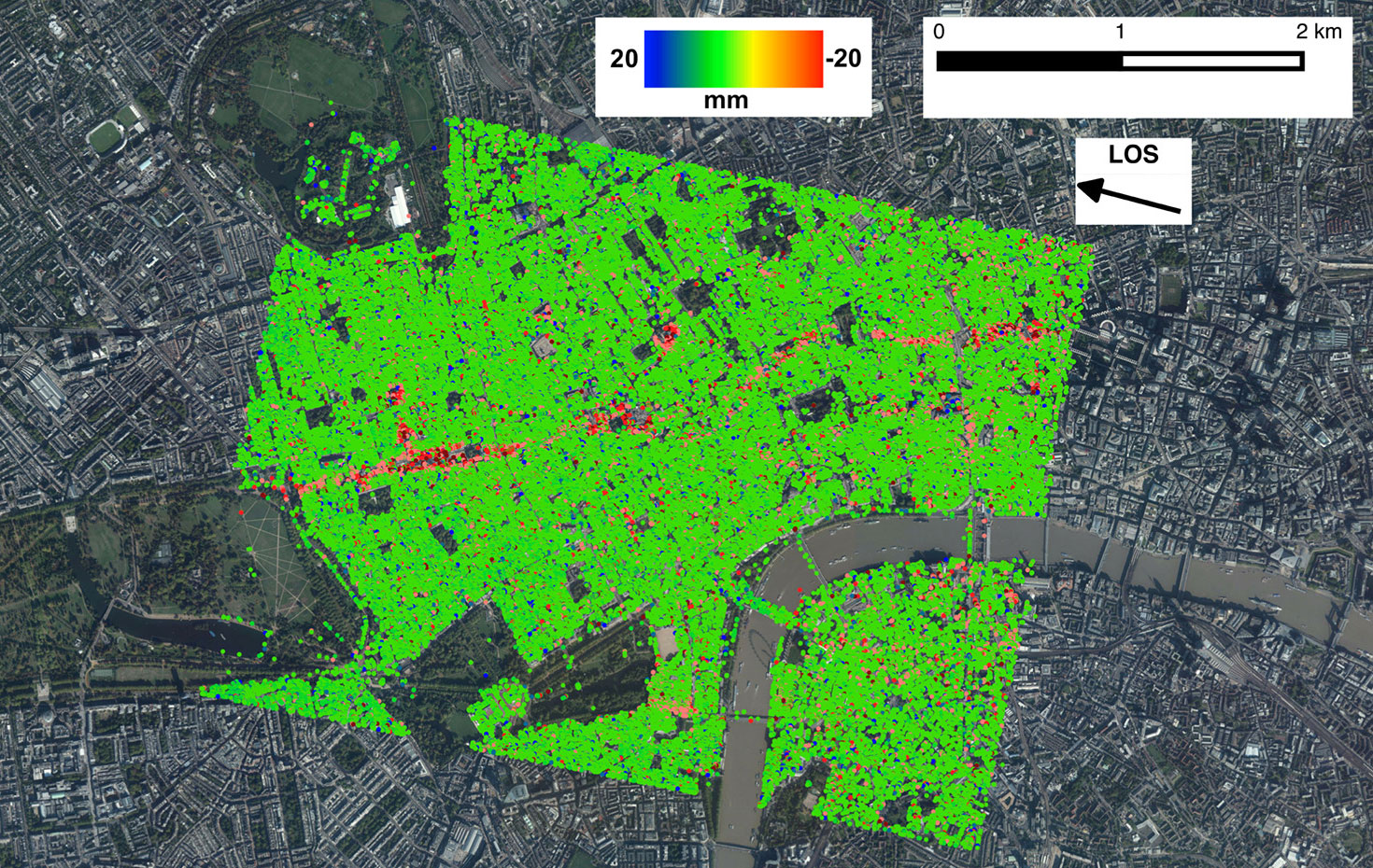
They were able to monitor the entire of central London.
The result is a map of displacements that has occurred between April 2011 and December 2015; the ground settlement above the Crossrail twin tunnels is evident.
The long term aim is not to prove that tunnels exist where we already know they are, but to offer an alternative way of monitoring tunnelling subsidence in real time, so that compensating can be deployed quicker.
The research was conducted in collaboration with the NASA Jet Propulsion Laboratory, Caltech; University of California, Berkeley; Purdue University; and the Italian Space Agency.
The research paper is here.


Did you not cover INSAR subsidence monitoring almost exactly a year ago, this time by Imperial College? Almost endlessly fascinating, especially the shock of the “hang on, what’s that there and why don’t I know about it?” type.
The ICL map is at http://mappinglondon.co.uk/2018/insar-ground-deformation-map/
interstingly it also makes it look like the british museum is sinking.. i wonder what’s going on around there.
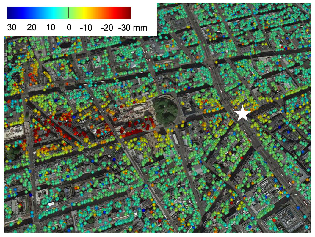
Most of the dots appear to be light green colour.
Does this mean that widespread minor subsidence is occurring, unrelated to tunnels?