A new app and website have been launched and is encouraging people to record details of all the buildings around them.
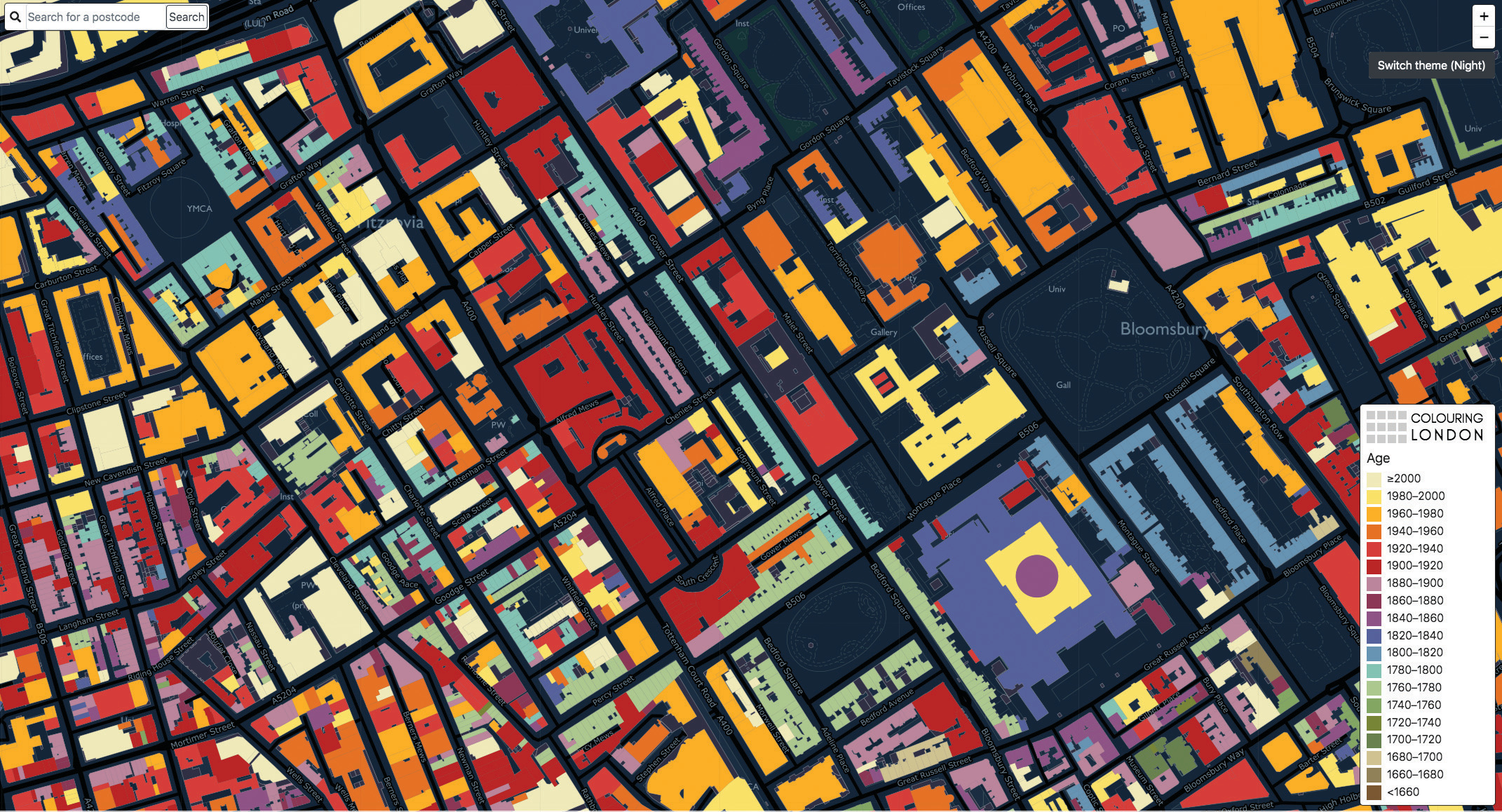
The Colouring London project aims to enable members of the public to contribute information about the buildings in the city through an easy-to-use visual interface. Buildings on the online map will colour as data are
added, gradually colouring the city.
Developed by UCL’s Bartlett Centre for Advanced Spatial Analysis (CASA), the open-source web platform aims to become the go-to source for information about the buildings of London, enabling Londoners, and anyone else who is interested, to access information which has not been freely available from a single source before.

There are a total of 12 different categories of statistical data: location, age, land-use, type, size & shape, construction methods and materials, who built and designed it, energy performance, streetscape, whether a public
asset, whether a listed or other special planning category, and whether the building is ‘liked’.
The platform the shows the collected data as coloured maps, allowing users to quickly and easily record and share the physical make-up of their neighbourhoods, boroughs and the wider city.
You can try out the map here.
The Colouring London project is based in London and is administered by UCL CASA, which acts as an independent guardian of the project. The source code for the platform has been made available on GitHub to allow other cities and organisations to create their own projects.
Three core partners, the Ordnance Survey, the Greater London Authority and Historic England, provided initial support and assistance that made development possible. Funding for the project has been secured from Historic England, The Engineering & Physical Sciences Research Council (EPSRC), UCL Innovation and Enterprise, and Innovate UK.


Or they could use OpenStreetMap, where information about the colours of buildings has been compiled by the public (and freely licensed) worldwide for quite a few years.
OpenStreetMap buildings data, even in places like London, is patchy at best, and quite often simply non-existent. This project is focused not on collecting building outlines, but rather their attributes. But you need the buildings to exist to be able to annotate them…