TfL has released another batch of documents which show every underground station in glorious 3D format.
They are technically axonometric diagrams, which is 3D-like, but not to scale, which becomes obvious when you see some of the vertiginous descents offered on some stairs and escalators.
In total, some 120 stations are represented in this motherlode of tube and map geekery. I’ve removed the redacted black blobs that are scatted over the originals, and generally cleaned them up a bit
To make displaying 124 large maps easier, I have broken them down into 5 pages.
Click on the drawings to enlarge them.
Note, the diagrams are indicative of layouts, and are not updated with changes (temporary or permanent).
Stations C-G
Stations CDEFG

Caledonian Road

Camden Town

Canada Water

Canary Wharf

Cannon Street

Chalk Farm

Chancery Lane

Charing Cross

Clapham Common

Clapham North

Clapham South


Covent Garden
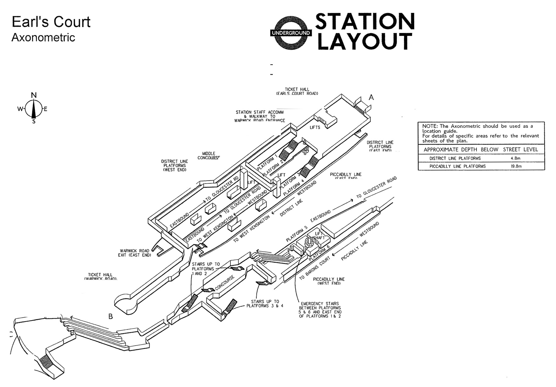
Earl’s Court
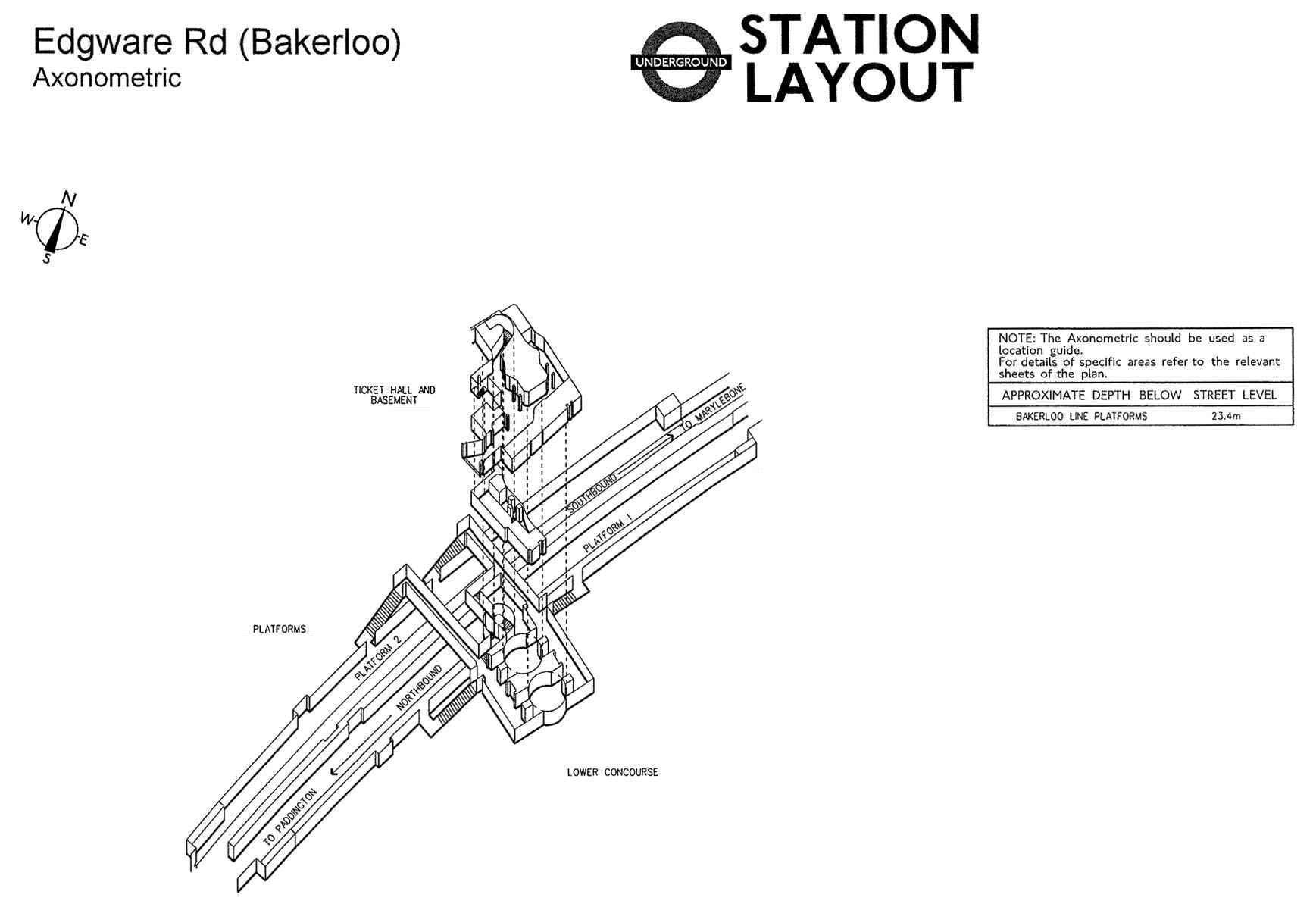
Edgware Road (Bakerloo line)
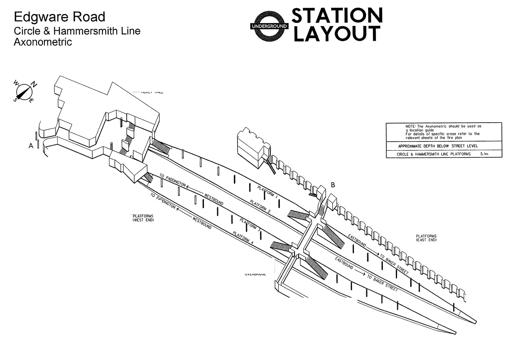
Edgware Road (Circle line)

Elephant & Castle
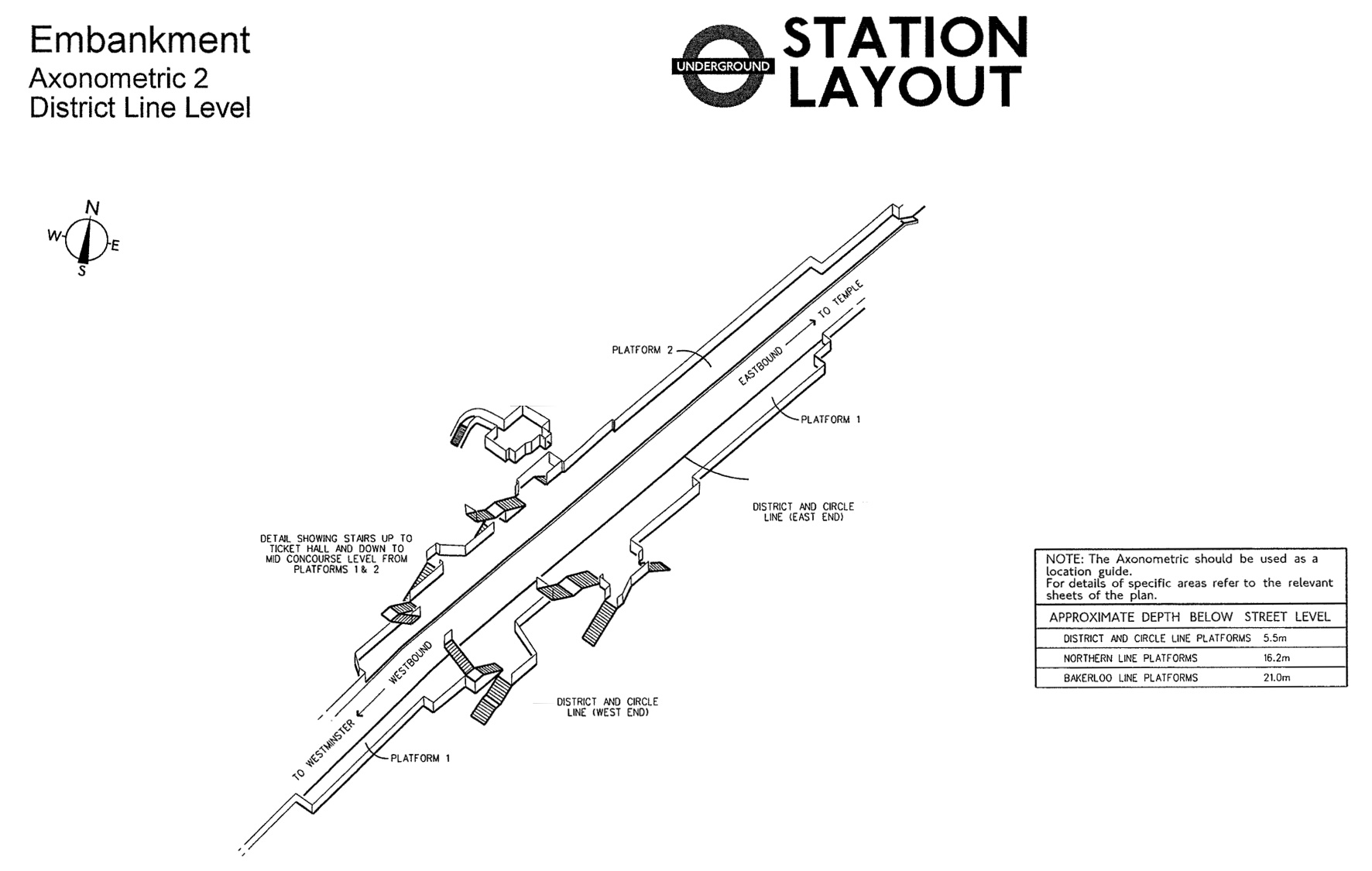
Embankment Station (District line)
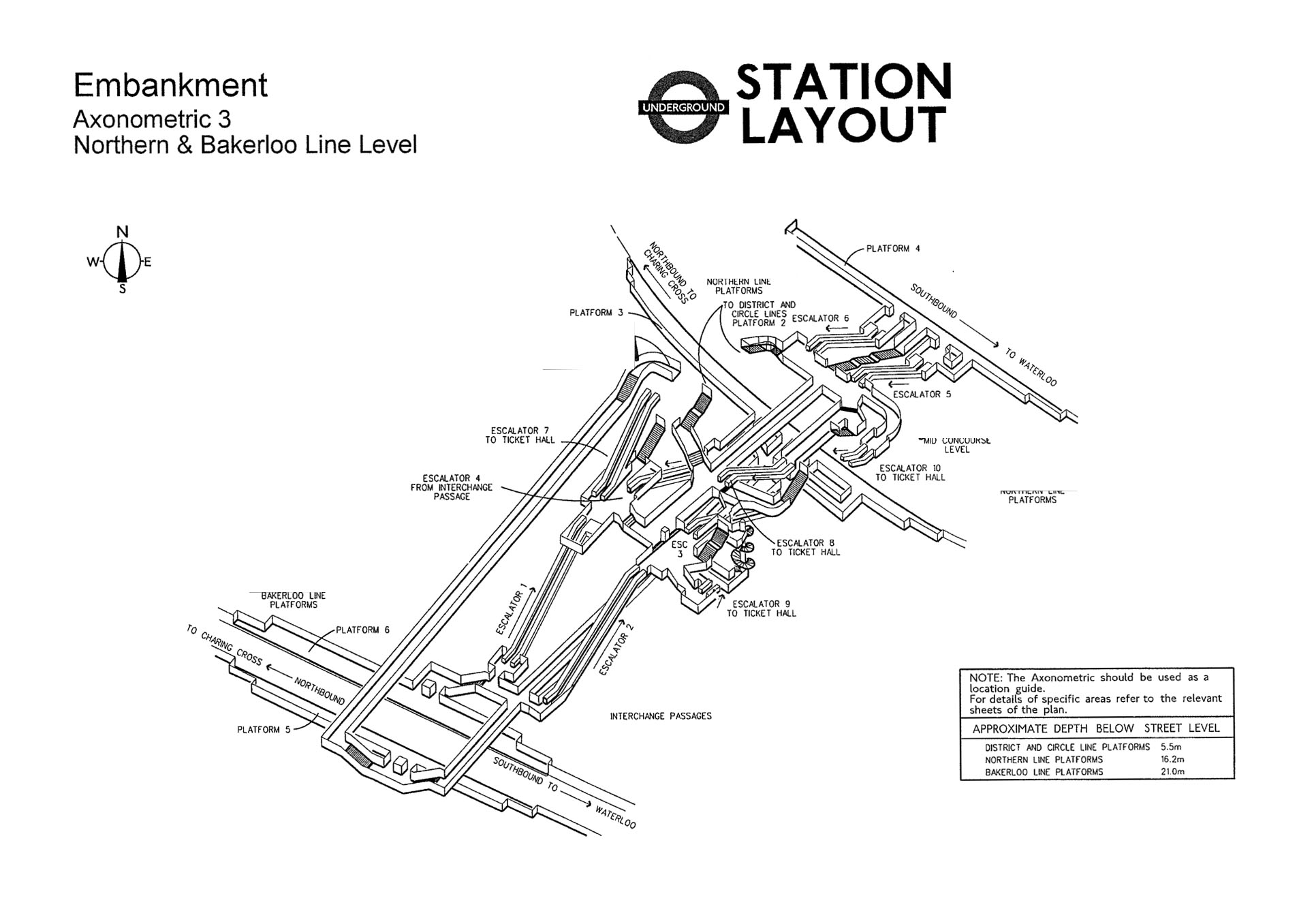
Embankment Station (Bakerloo & Northern lines)
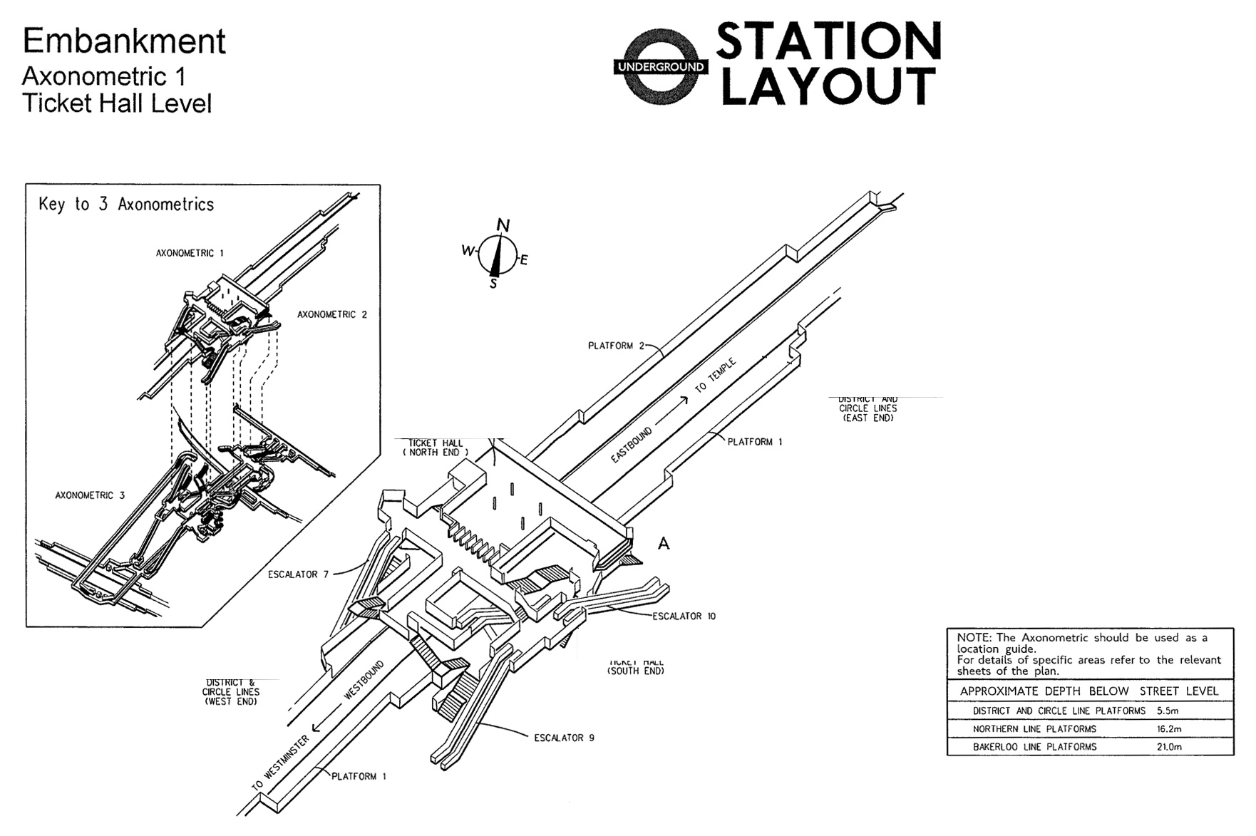
Embankment Station (Ticket Hall)
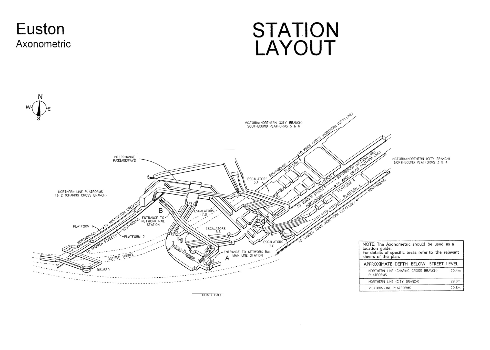
Euston

Euston Square

Finsbury Park

Fulham Broadway

Gants Hill
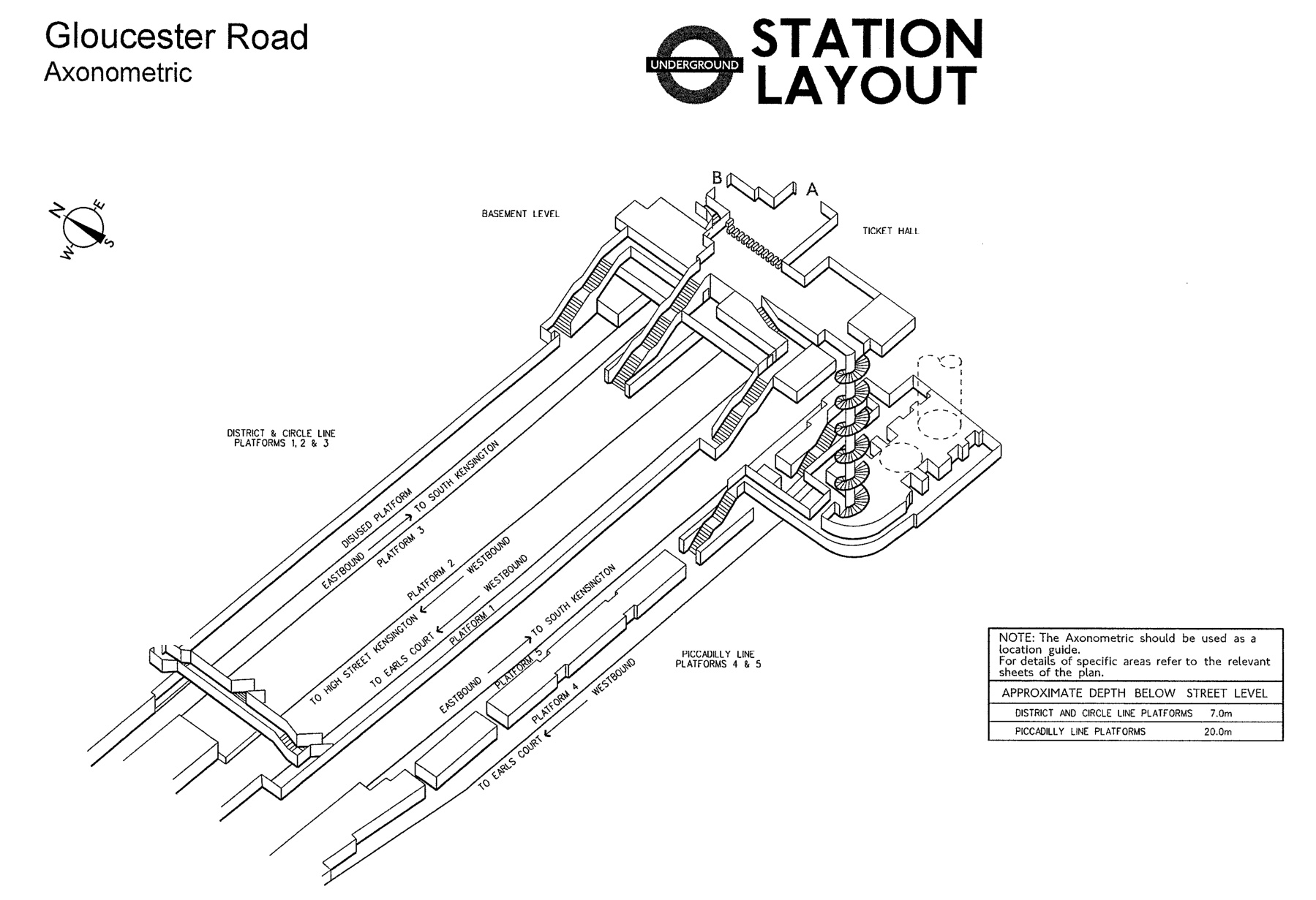
Gloucester Road

Goodge Street
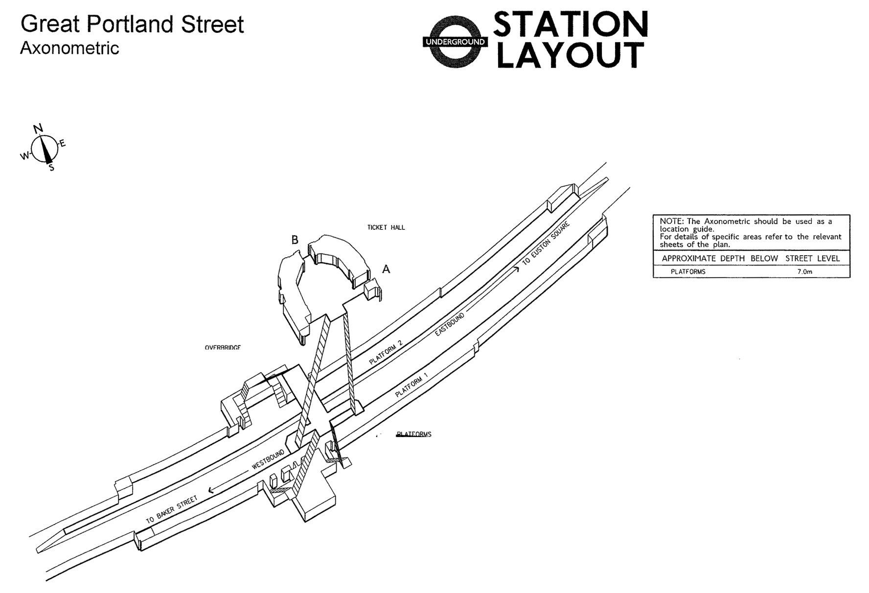
Great Portland Street

Green Park
Stations C-G
Original reference files here.
Copyright
Copyright of the diagrams is owned by TfL. If you would like to re-use the information please contact TfL. Requests for re-use will be considered in accordance with the Re-use of Public Sector Information Regulations 2005 and, where the disclosed information is a dataset, section 11a of the Freedom of Information Act.


Rather delightfully, one of the side entrances to the Norman Foster-designed Canary Wharf station is named as the “Fosterito” entrance 🙂
Yes, the “fosterito” entrance is a name that TfL uses, but hardly anyone outside the organisation has heard of.
Hence: https://www.ianvisits.co.uk/blog/2012/07/19/confusing-email-about-olympic-changes-to-canary-wharf/
I remember being taken to see the recently completed Foster and Partners entrances to the Bilbao metro network (completed around the same time as the Bilbao Guggenheim). They were nicknamed there as “Fosteritas” – perhaps TfL got it from there? I think the Bilbao entrances came before Canary Wharf.
No Bakerloo line platorms at Charing Cross?
Just wondering if there is a Heathrow Terminal 5 map?
Technically, T5 is a Heathrow Express station, which happens to have LU platforms. So it wont appear in LU documentation of this sort.
Neither of the Hammersmiths appear to be here?
Neither of the Hammersmiths have tunnels.
Thank you for your time and skill in removing ‘the redacted black blobs’ on the originals, which have surfaced on other sites sans your efforts, and I can’t read or glean any information from those at all !
Finchley Road station is missing
It also doesn’t have any tunnels, so difficult to show a diagram of them.
This is rather satisfying! Although the one I’m looking for is Canning Town, which I don’t see. Perhaps because it’s also a DLR?
Canning Town isn’t underground, so no map of the tunnels.
The emergency stairs at Earls Court Station from platforms 5 & 6 originally went all the way up to the booking hall.
Thank you for mapping out green park, I’ve been trying to avoid that ridiculous mile long uphill ramp but somehow just get hearded along that way by the signs. It always did feel like it went around in a big circle!