Starting the walk around modern London following the route of the lost fortifications erected during the English Civil War
Notes:
- Bulwarks and redoubts were types of fortifications – basically small forts.
- Hornwork was another type of fortification, usually built near a larger fort or building to create another layer of defence.
- Flanks were the sides.
- A battery was a strong position that held one or more cannons.
- Breastwork meant steep mounds of earth or stone with fences to stop attacking forces.

Or download all 5 articles onto a Kindle device
Day 1
And now, coming to my maine purpose, I wish the reader should but conceive, as my pen shal let him see, the fairest encompassed city in all Europe, which my pedestriall march in twelve hours time painfully performed. And thus, three dayes before my departure thence, I approached, to make the toure round about, and descending to the lower end of Wappine, there I beganne my circuit.
1) A Bulwark and half on the Hill at the North-end of Gravel-Lane
Then here, close by the houses and the river Thames, I found a seven-angled fort, erected of turffe, sand, watles, and earthen worke, (as all the rest are composed of the like,) having nine port-holes, and as many cannons; and, near the top, round about pallosaded with sharpe wooden stakes, fixt in the bulwarkes, right out, and a foot distant from another, which are defensive for suddain scalets, and single ditched below, with a court du guard within.
 Starting, for want of a better location, at Wapping station. No one is really sure what was located at the river side, if indeed, anything was, but suggestions of a chain across the river would indicate something was in this area.
But on to the first of the official forts. Turn up Wapping Lane, (formerly Old Gravel Lane) towards The Highway.
Past the old style shopping, with their independent greengrocers and butchers, and it’s fairly easy to miss, but do take a look at St Peter’s Church, and if the doors are open pop inside, for the ceiling is quite impressive and the lady chapel equally delightful.
 Now, a mini detor, just past the church is a green, and in the corner a brick house standing alone. Wander over and have a look at the front, which is decorated with two painted children.
This is Raine’s House, which was built in 1719 as a school for poor children at a time when few could afford such a luxury. The statues on the outside are typical signs of a school, but these are replicas as the originals were taken when the school moved out of the building.
The school still exists, as Raine’s Foundation School, and is not far away in Bethnal Green.
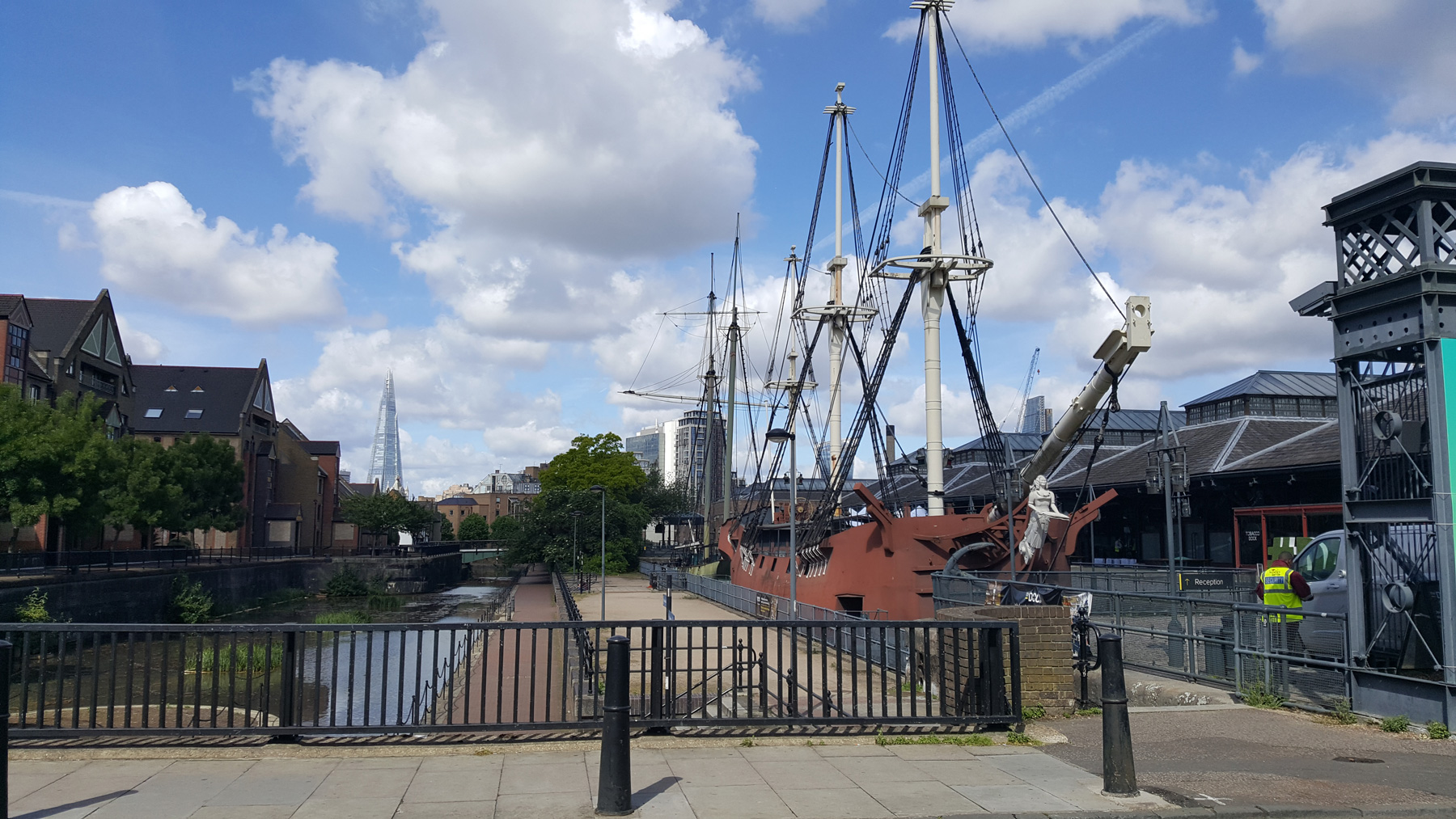 Carry on to the imposing brick walls of Tobacco Dock, and its fake pirate ships.
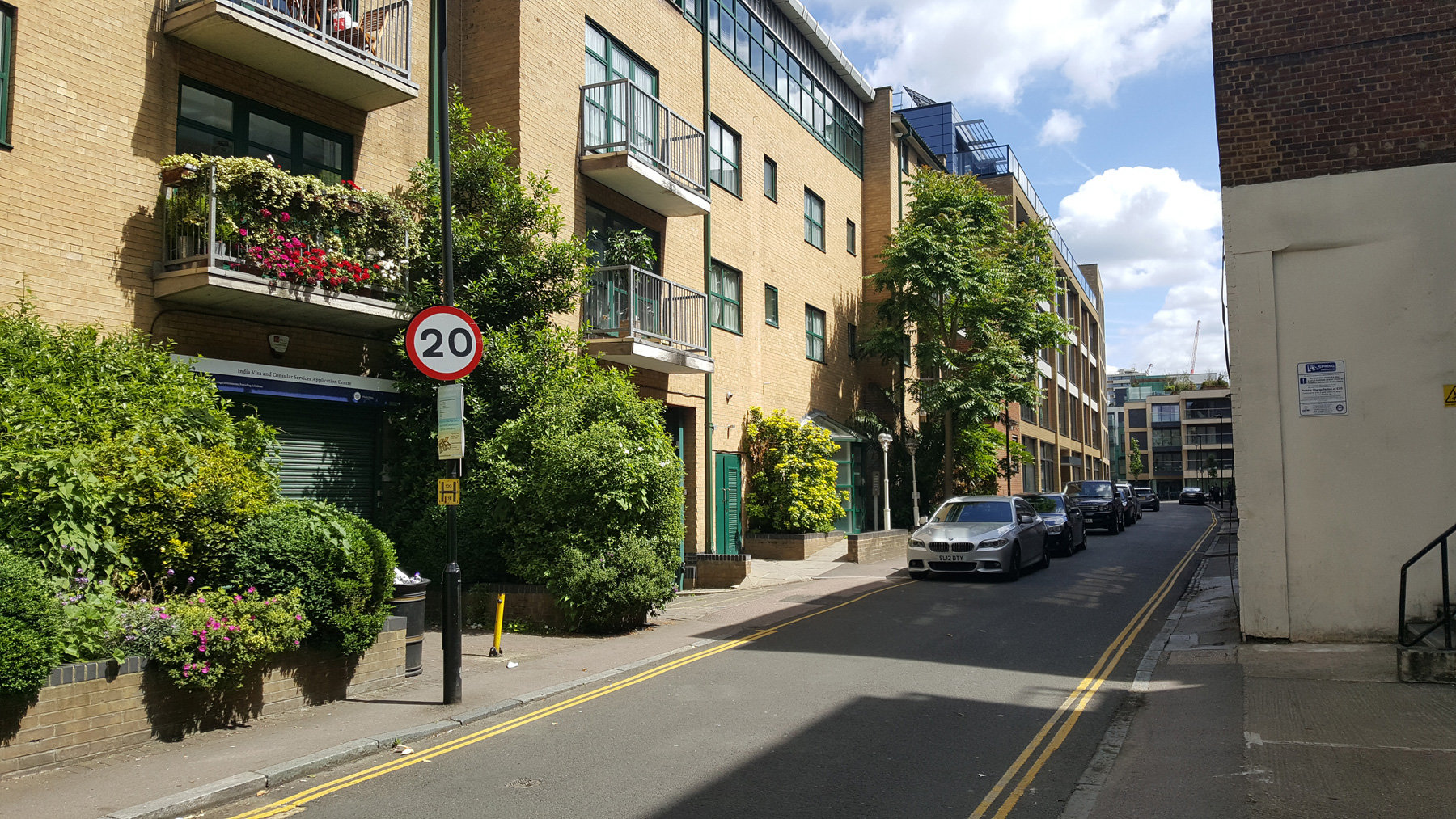
If you want, pop into Tobacco Dock if there’s not a private event, as it’s an eerie space that is still kept open even though it hardly has any visitors. At the top of the road though, it is likely that the junction of the two roads is where we would have come across the first Fort.
The site of this long lost civil war fort is today, a branch of McDonalds.
2) A Hornwork near the Windmill in White-chappel Road.
Advancing thence along the trench dyke (for all the trenches are deep ditched about) which runneth through Wappine fields to the further end of Whitechappell, a great way without Aldgate, and on the road-way to Essex, I saw a nine-angled fort, only pallosaded and single ditched, and planted with seven pieces of brazen ordonance, and a court du guard, composed of timber, and thatched with tyle-stone, as all the rest are: where, towards Myle-end Green, I beheld there two pettie forts, or redoubts, each of them with three ports, and they cannoned, stand within an intrenched closure, having five courts, du guard, that secure the passage-way.
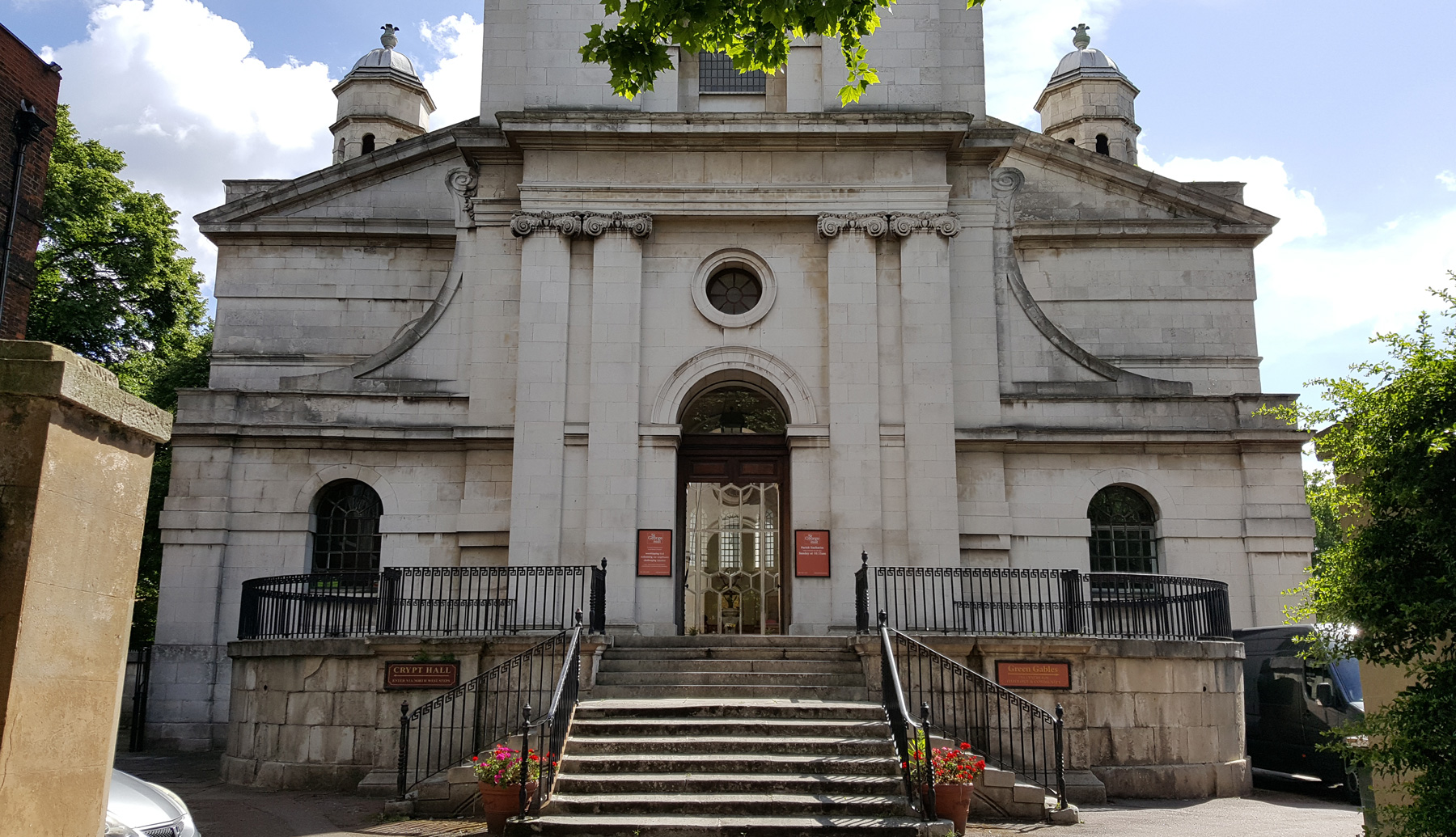 The next fort along follows the route of an old road, Cannon Street Road, so cross over at the traffic lights, and just head straight north. On your right is St George in the East, which looks typically Georgian on the outside, but thanks to WW2, is totally modern on the inside.
Further up, the junction with Cable Street has a certain notoriety, being the burial of a probably unjustly accused murderer. He was buried in the middle of the road and later his skull ended up in the pub on the corner.
 Just to the north, is the railway bridge, and for a very short period of time, there used to be a station here. It was only open for a few years, and closed in 1848, probably due to lack of use. There’s no trace of the old station, but there is an interesting garden on the opposite side of the road from where it once stood. The garden was made by former drug addicts from a local hospice.
Passing the lost railway station, head up New Road, which seems to have been lain along otherwise country fields in the 17th century, so possibly following the line of the demolished fortifications walls.
Just as the road starts to get some shops, take a look to the brick building on the left side — with the blue border at the top. Yes, it’s an outpost of the Raine’s school you were looking at back near Wapping.
Carry on, and cross over Commercial Road, and look out for a red brick building on the left that stands out as slightly different from the Georgian era homes, and have a look at the blue plaque on the outside.
The first indoor meeting of the Salvation Army was held here in September 1865. The Salvation Army was founded nearby as it happens, in Whitechappel, although their main base is now in Demark Hill with its massive tower.
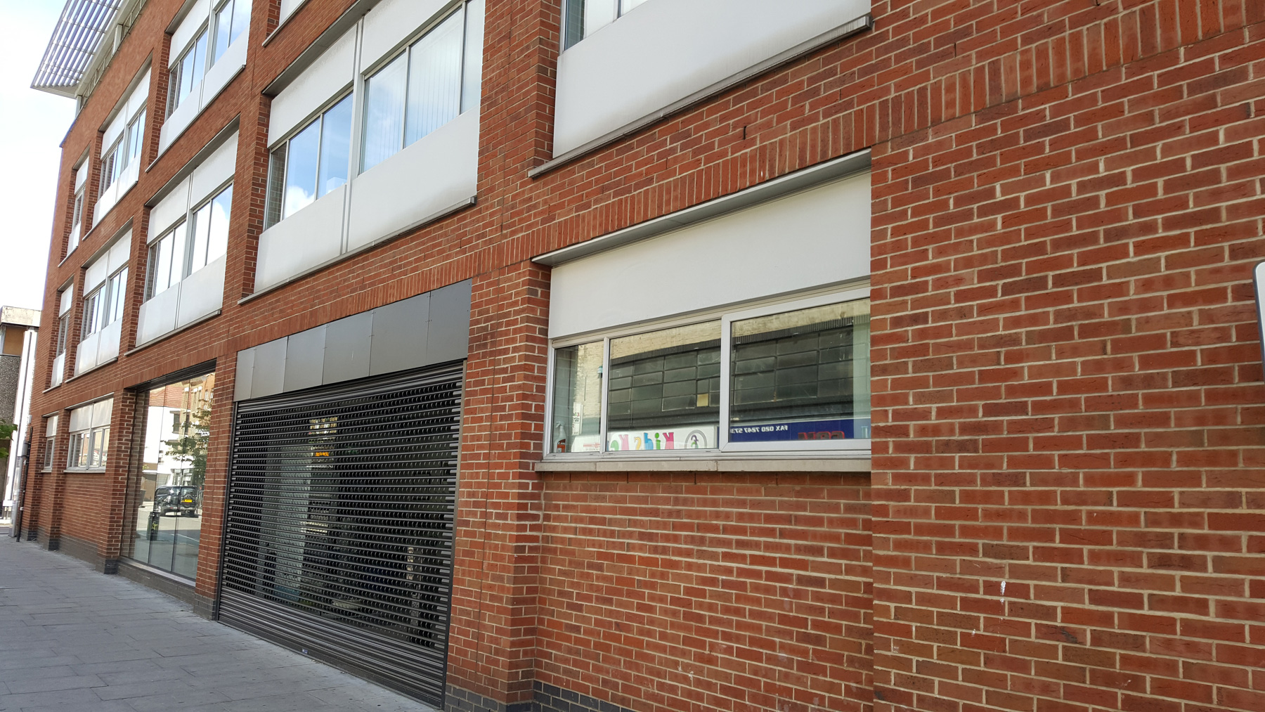 Near the top of the road, stop at the red brick building just past the more distinctive metal clad Queen Mary Innovation Centre. That newish, and frankly rather boring red building conceals part of the fortification wall. Archeologists working in 1994 when that building site was cleared found evidence of the ditch which ran alongside the fortification wall.
The dimensions of the uncovered ditch were given as being 5.5m wide and 1.4m deep. The ditch wouldn’t have been dry, and although not a full moat, it would have been quite water logged at the bottom, making an attack even more difficult. The excavations also suggest the ditch might have been still visible as late as the 18th century, when it silted up.
 But, continue up the road a bit further, and at the top, just before the junction of Whitechapel Road is Mount Terrace, with a short row of houses.
Here you are now standing on probably the site of the most famous fortification – which was in later times known as Whitechappel Mount. Although nothing was left of the Fort itself, there was a huge mound of soil here right up to Victorian times. It is a mark of how little the Civil War fortifications had become that the origin of the mound was no longer known.
It is possible that the mound was always there, and the fort built on it, or maybe it is itself made from the remains of the fort – no one knows. There is a reference to a mound at Mile End in Stow’s Annals referring to Jack Cade’s Rebellion in 1450.
Some later claims suggest that it was piled up with the debris from the Great Fire of London, but when it was flattened in 1808, no such remains were found.

3) A Redoubt with 2 Flanks, near Brick-Lane.
4) A Redoubt with 4 Flanks, in Hackney Road, Shoreditch.
5) A Redoubt with 4 Flanks, in Kingsland Road, Shoreditch.
From White-chappell Fort, north-westward, I trenched along the trenches to Shoarditch Fort, standing mainly quadrangled, single pallosaded, and single ditched, carrying, on three corners of the four, eight demi-canons, and a royall court du guard within : and without which, and at Kingsland, (being the old post way for Scotland,) there stands two earthen rampires, with two courts du guard.
To get to the next Fort, you could if you want follow what is likely to be a remarkable coincidence, for the railway happens to follow pretty much the same route, but only part of the way.
So, the best route is to cross Whitechappel Road and walk up Vallance Road, until you get to Buxton Street on the left. The corner is notable for the black frontage house, with a blue plaque on the side.
 This is the former Dewdrop Inn (a pun on ‘Do Drop In’), which offered a refuge for homeless women, and was set up by Mary Hughes, who had spent her life championing the rights of people forced into workhouses.
One of her early victories was to let workers have two cups of tea per day instead of one.
She later moved to this house and was known to often sleep on the floor so that someone else in need could have her own bed.
Turn into Buxton Street, and go past (or detour into) Spitalfields City Farm. Once you’ve said hello to the animals, carry on along to Allen Gardens, and either cut across the gardens, or walk along the road to the end of the gardens and turn right up Code Street.
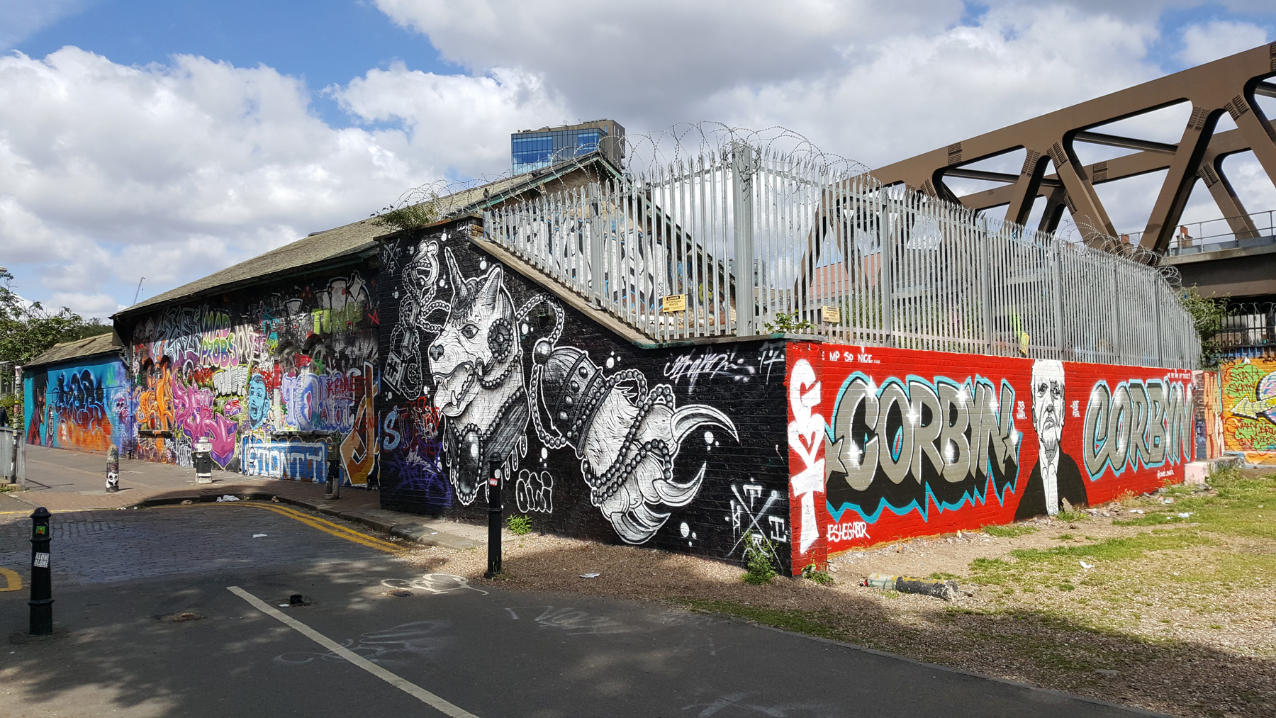 At the top of the street is a very distinctive building. Well, the building is fairly ordinary, but it is always covered with a regularly changing amount of street art graffiti.
The building though, is the former Shoreditch tube station, that opened in 1876 as a stop on the line out of Liverpool Street station, was later taken over the Metropolitan line on the Underground, and closed in 2006 when the new Overground station opened nearby.
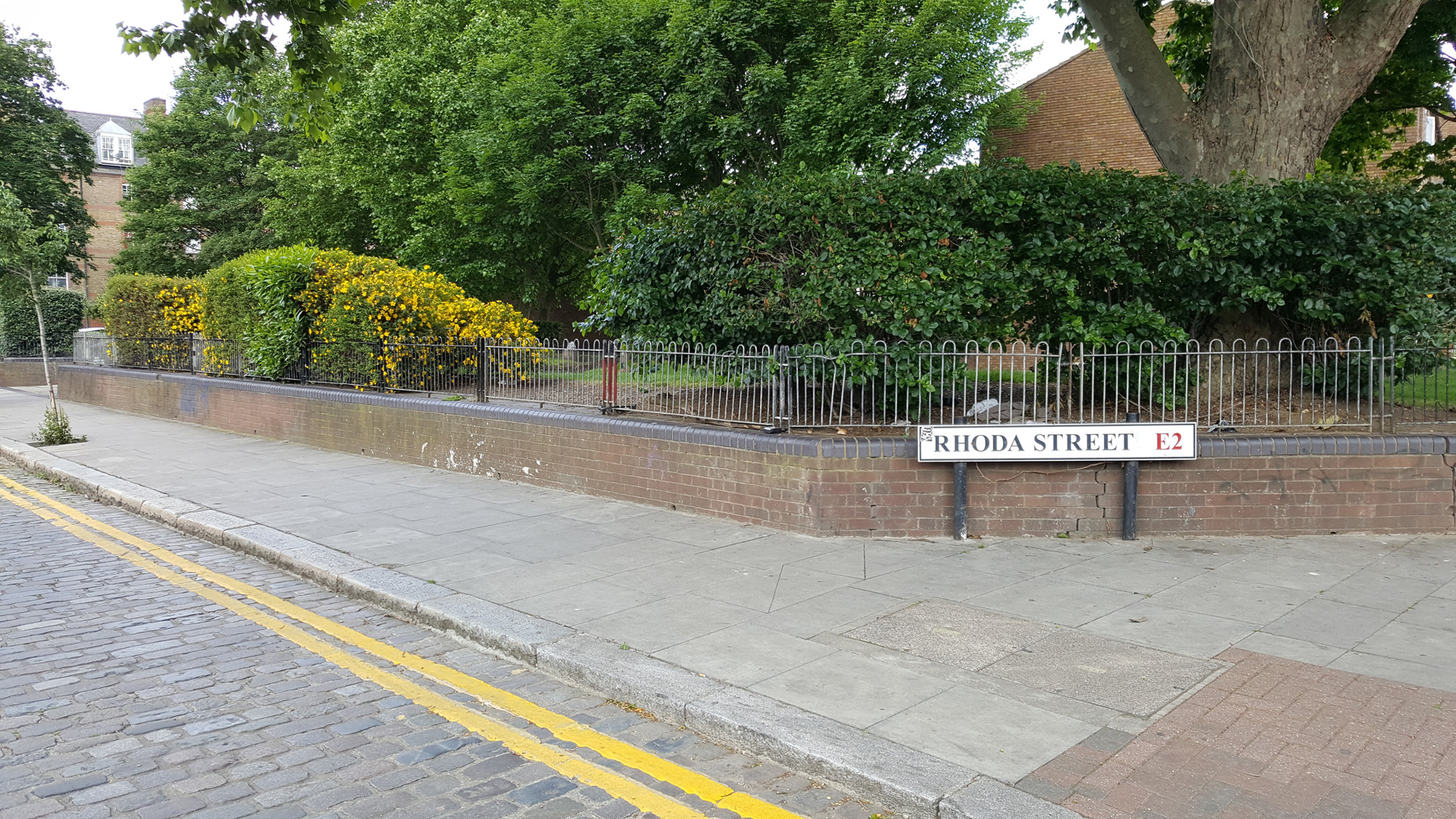
Carry along the alley, and when you get to Brick Lane, head north and cross over Bethnal Green Road, heading north until you get to Rhonda Street. Turn here at the park into Swanfield Street.
 Again, don’t see what is often sheer coincidence, but that park you are standing next to is roughly where the fort stood. The park may be the exact site, but it was housing in the 19th century, so the empty space is just a coincidence caused by another example of post war clearance.
Although almost certainly not part of the fortifications, archeologists recently uncovered a very odd “star fort” a short distance away, near Spitalfields. It’s odd in that to all intents, it appears to be facing towards the city, as if to put down insurrections by the people, rather than to protect them from outsiders.
The location of the next fort is, a bit difficult. The map shows it to the south of the “road to hackney”, but there’s a hulking great church on that site, and it predates the civil war — so where was the fort?
Historic England place it to the north of the church, so that’s where we’re heading.
 Head up Swanfield Street, and take the first turn into Rochelle Street, and at the top of the road is the impressive Boundary Estate with its raised roundabout. The raised mound is the rubble from the old slums that were cleared to construct the estate you’re in now.
As nice as it is, the slum clearance has a dark side, as the previous occupants were kicked out to other places, and the homes here rented to “decent” folk.
Walk around the roundabout — or head up and over it — to Calvert Ave and head along to Shoreditch High Street, then turn right.
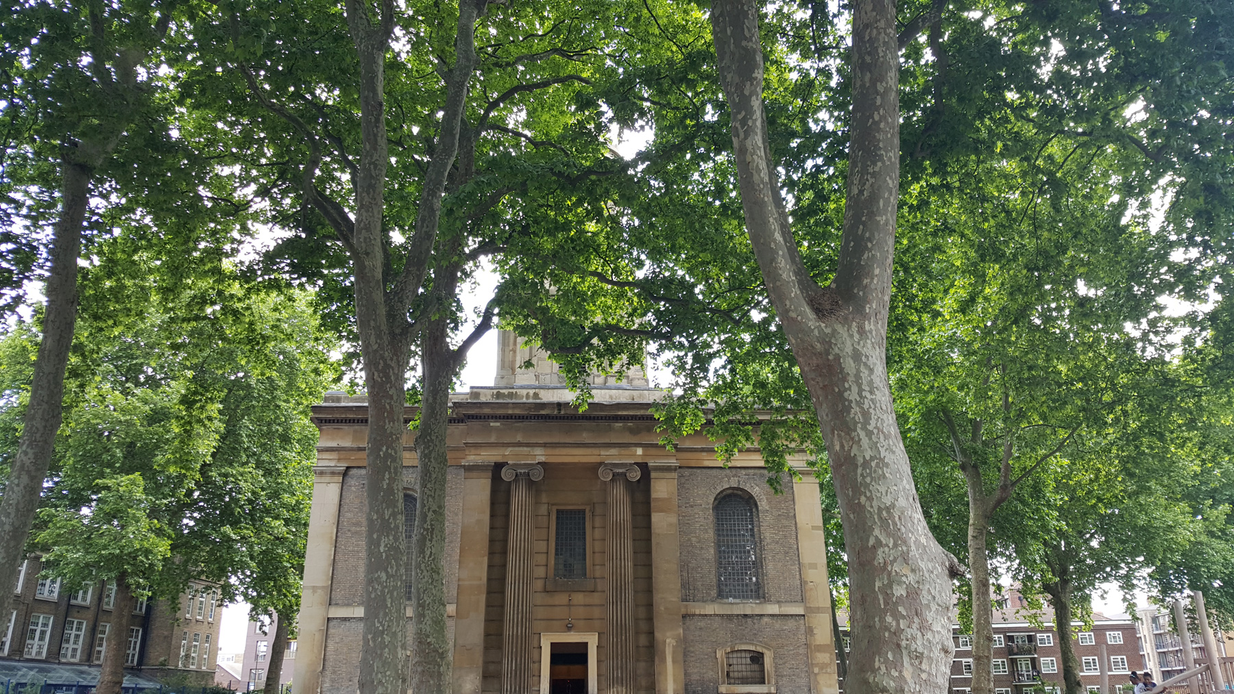
Here is the St Leonard’s Church, which claims to be on the site of the oldest church in London, and during the Civil War would have overlooked the fort that guarded this important road.
 Also have a look across the road at the Old Shoreditch Station. That’s no hipster rebranding, it actually is the site of an old railway station that closed in 1940, although the building frontage is newer than that.
Now, the location of the fort is essentially a bit of a guess, based in part on the possible location of the next fort along. But I am going to propose heading up Hackney Road and turn left into Waterson Street (formerly Union Street).
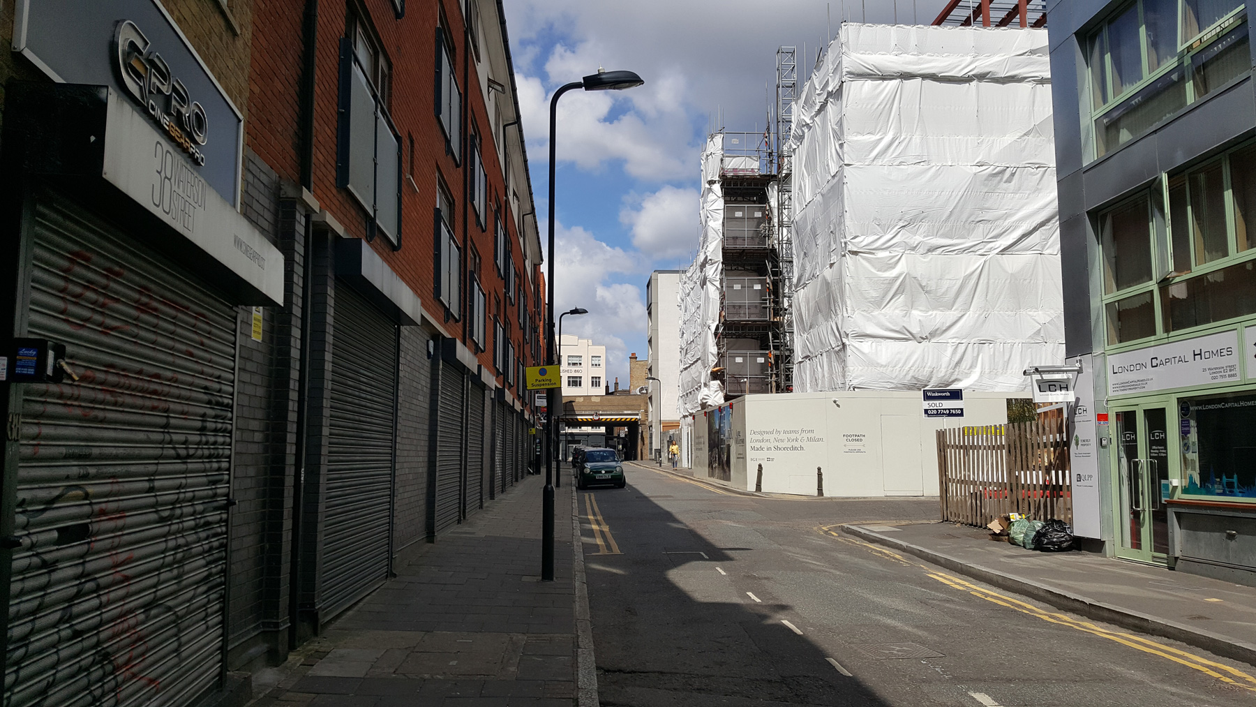 Sort of around here was the fort. I can’t say anymore, just it was sort of hereabouts. Somewhere.
So lets move on.
Thence return’d, I followed along the champaine breast-workes to Hogston, where I found a quadrat fort, well pallosaded, and planted with five cannons at the two field corners; the strength is double ditched, and, betweene the two, it is strongly barrocaded with wooden stakes, everie stake, neare the top, being fenced with three iron hookes of a span long.
This appears to be a reference to one of a number of stand-alone forts not connected to the wall itself a bit further outside London.
 Head along Waterson Street then turn left into Kingsland Road, cross over and just under the railway, turn right into Drysdale Street. At the end, cross over to the right, and head along Mundy Street, past Hoxton Square – where hints of a defensive ditch have been found, but not fully investigated.
At the north of Hoxton Square is St Monica’s church, which was in the news a few years back when original Pugin gothic revival decorations were found under the modern paintwork.
 Carry along Bowling Green Walk, and at the end, turn right up Pitfield Street. As you head up, on the left side in front of the shops do notice the stone water trough, now filled with plants.
This was installed, along with many more around London to provide fresh drinking water fountains for humans, and troughs for cattle. The charity still exists today and its focus is now in countries that lack reliable clean water.
A bit further up is the road junction with Fanshaw Street, with the church of St John the Baptist in front of you.
 This probably was the site of the fort.
I base this on an 1801 map which shows a mark called “pimlico” here, in the fields, and there are some references to the fort being called Pimlico Fort, and the lands were later turned into pleasure gardens.
If the church is open, pop in to the 190 year old building, as it has a spectacular painted ceiling.
6) A Battery & Breastwork, at Mountmill.
Thence I marched through Fineberry fields along the trench, (enclosing there Moorefields,) and came to Mount Mil-hill Fort, (for all the forts about are blank and blank in sight of other,) where being arryved, I found it standing on the high-way, near to the Red Bull: This is a large and singular fortification, having a fort above, and within a fort, the lowest consisting of five angles; two whereof, towards the fields, are each of them thrice ported, having as many great cannon, with a tlanking piece from a hid corner: the upper fort, standing circular, is furnished with eleven pieces of cannon reall, which command all the rest; and upon the bosome top of all standeth a windmill: the lower bulwarks are first pallosaded round about, and near their tops, and then in the middle flank, between the two ditches, strongly barrocaded; beside two coun- tercarps, and three redoubts of lesser importance; yet all defensive: this is one of the chief forts about the city, and first erected.
It’s quite a long walk to the next set of forts.
Just opposite the church to the left is Bevenden Street. This road, and the ones around it were laid out by the City of London livery company, the Haberdashers, who acquired the farmland in 1690, and turned it into housing in 1802.
 Today the area is routine housing, so head down here, then cross over to Nile Street, and go to the end. There’s just one building on this street that has any Egyptian theme to it, and not much at that, which is a shame.
Turn left to City Road, cross over and go right a bit until you reach Mora Street. Go down here, then turn left into Lever Street, cross over Central Street, and head to the end.
Turn left into Goswell road and head along until you get to the second turning on the left, which is Pear Tree Street, where a possible hint of the wall was found in excavations and a report by MOLA said that “it is at least an interesting possibility that the dark ‘peaty’ layers [observed in Test Pits] are fills of Civil War defensive ditches.”
 There’s not much to see here, just houses, but you have probably stood on the wall itself, indirecly.
Head back a bit further north, and stop at Seward Street — this was roughly the site of the Mountmill fort. If you turn along that street, just to the left is indeed a very short Mount Mills street.
The road you just walked down, Lever Street was also once called Radcliffe Mount, which may add support to the idea that the area was known for the fort on the site.
 The site is also said to be the location for a plague pit.
7) A Battery & Breastwork, at St. John’s Street end.
Thence footing along the trench dyke, (which is three yards thick, and on the ditch side twice as high,) 1 courted Islington, at the lower end whereof I found a strong and large strength, called Waterfield Fort, having, within two utter workes, a circularie mount, stored with nine great pieces of artillerie, and on the point of a countercarp, three pieces more: there I saw the longest court du guard (being longer then two ordinarie churches) that I have seen as yet.
Returning to Goswell Road, carry on north back across Lever Street, and on the left, turn up Sebastian Street.
Remembering not to see things that aren’t necessarily there, it is possibly a coincidence that this road now runs in an almost perfect line with where the fortified wall would have run.
 So with a bit of imagination, you’re walking on the edge of London, with safety to the left and the Royalist threat to your right.
This rather charming area of Georgian houses is Northampton Square which was laid out in 1832, by unsurprisingly, the Marquess of Northampton. A fountain in the square commemorates the 1885 restoration of the gardens.
Cross the park, and head along Wyclif Street and turn right at the end. Do pay attention to the red brick building you’re walking beside.
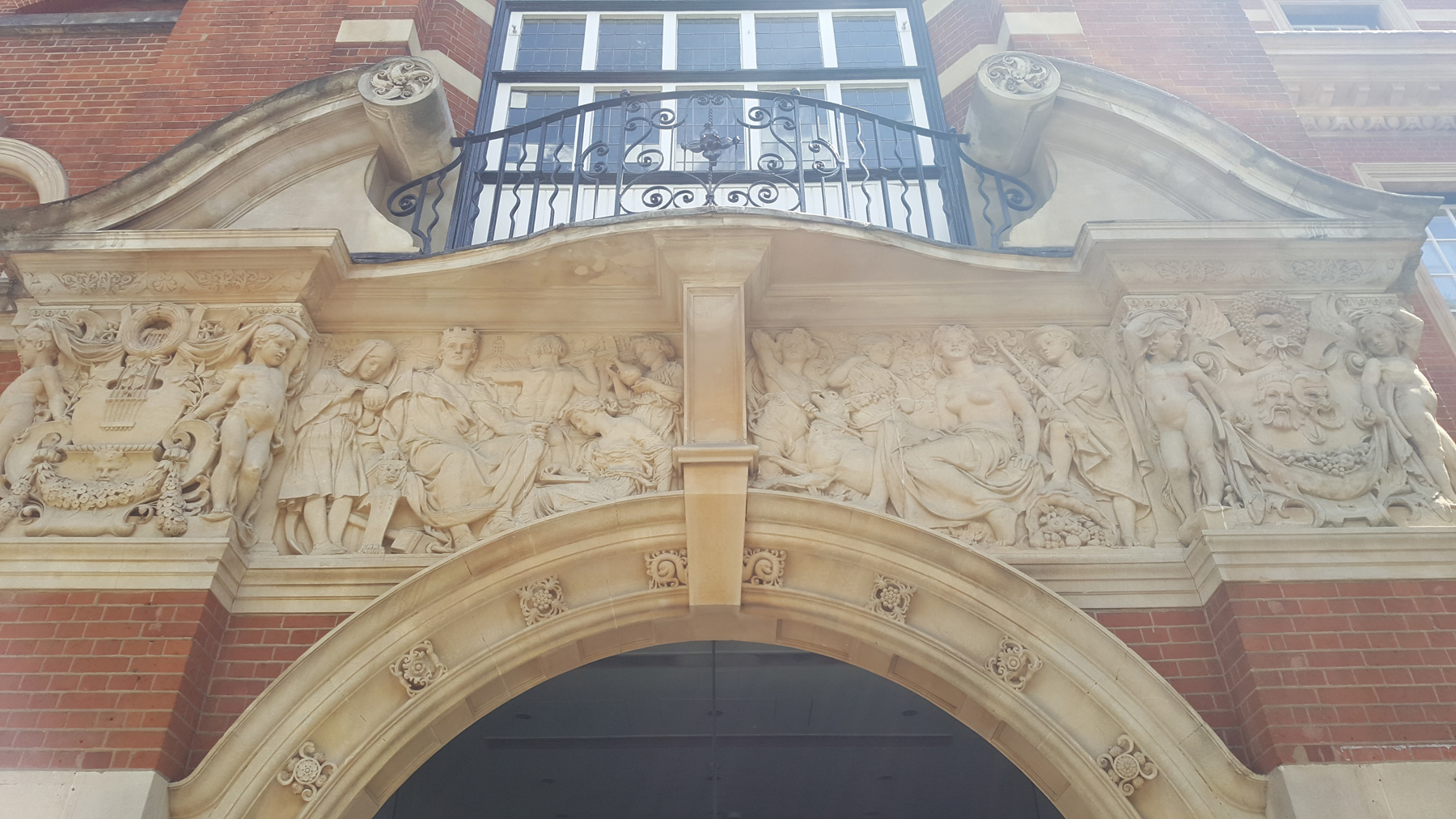 Well, not the building, but the doorway, which is a riot of decorative reliefs.
The architect of the building was EW Mountford, who also built the Old Bailey, and the clock at the top of the tower was supplied by the same firm that made the Great Clock for the Elizabeth Tower in Parliament.
Unfortunately, you need to avert your gaze and look across the road to where the rather gray Rhind Building stands.
 This was roughly the site of the fort.
8) A Small Redoubt, near Islington Pound.
There was also a small fort standing alone further up the road, but this seems impossible to locate, so lets pretend it didn’t exist.
Part 2 tomorrow, or download all 5 articles onto a Kindle device.
- Introduction
- Walk 1
- Walk 2
- Walk 3
- Walk 4


Been following along on Google streetview. Super interesting on bits of London I’m unfamiliar with.
2 corrections: its Rhoda St. not Rhonda St. and you turn Right (not Left) from Mora St onto Lever St.