TfL has released another batch of documents which show every underground station in glorious 3D format.
They are technically axonometric diagrams, which is 3D-like, but not to scale, which becomes obvious when you see some of the vertiginous descents offered on some stairs and escalators.
In total, some 120 stations are represented in this motherlode of tube and map geekery. I’ve removed the redacted black blobs that are scatted over the originals, and generally cleaned them up a bit
To make displaying 124 large maps easier, I have broken them down into 5 pages.
Click on the drawings to enlarge them.
Note, the diagrams are indicative of layouts, and are not updated with changes (temporary or permanent).
Stations H-M
Stations HIJKLM

Hampstead

Hatton Cross
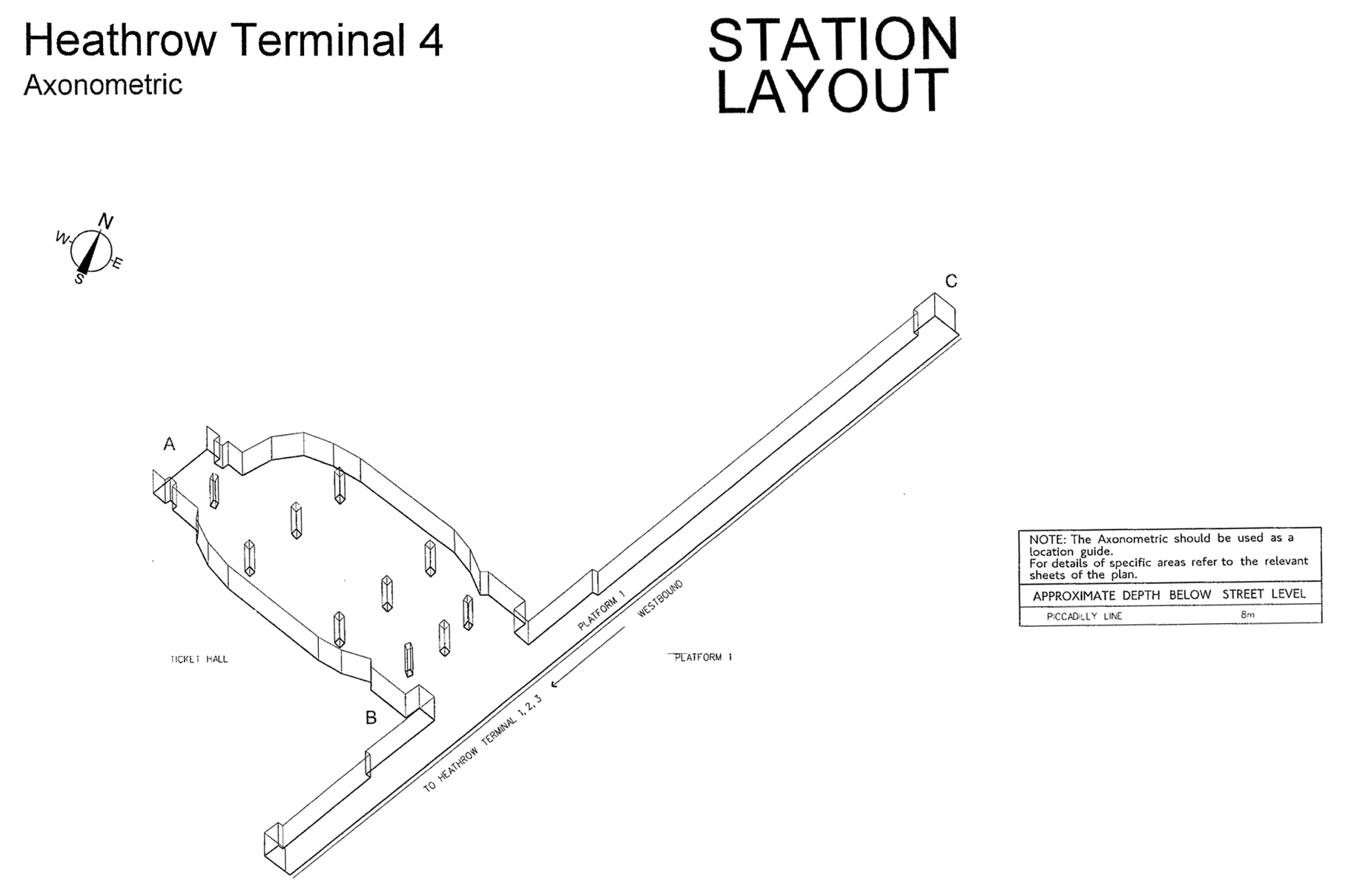
Heathrow Terminal 4

Heathrow Terminal’s 123

Highbury & Islington

Highgate

High Street Kensington

Holborn
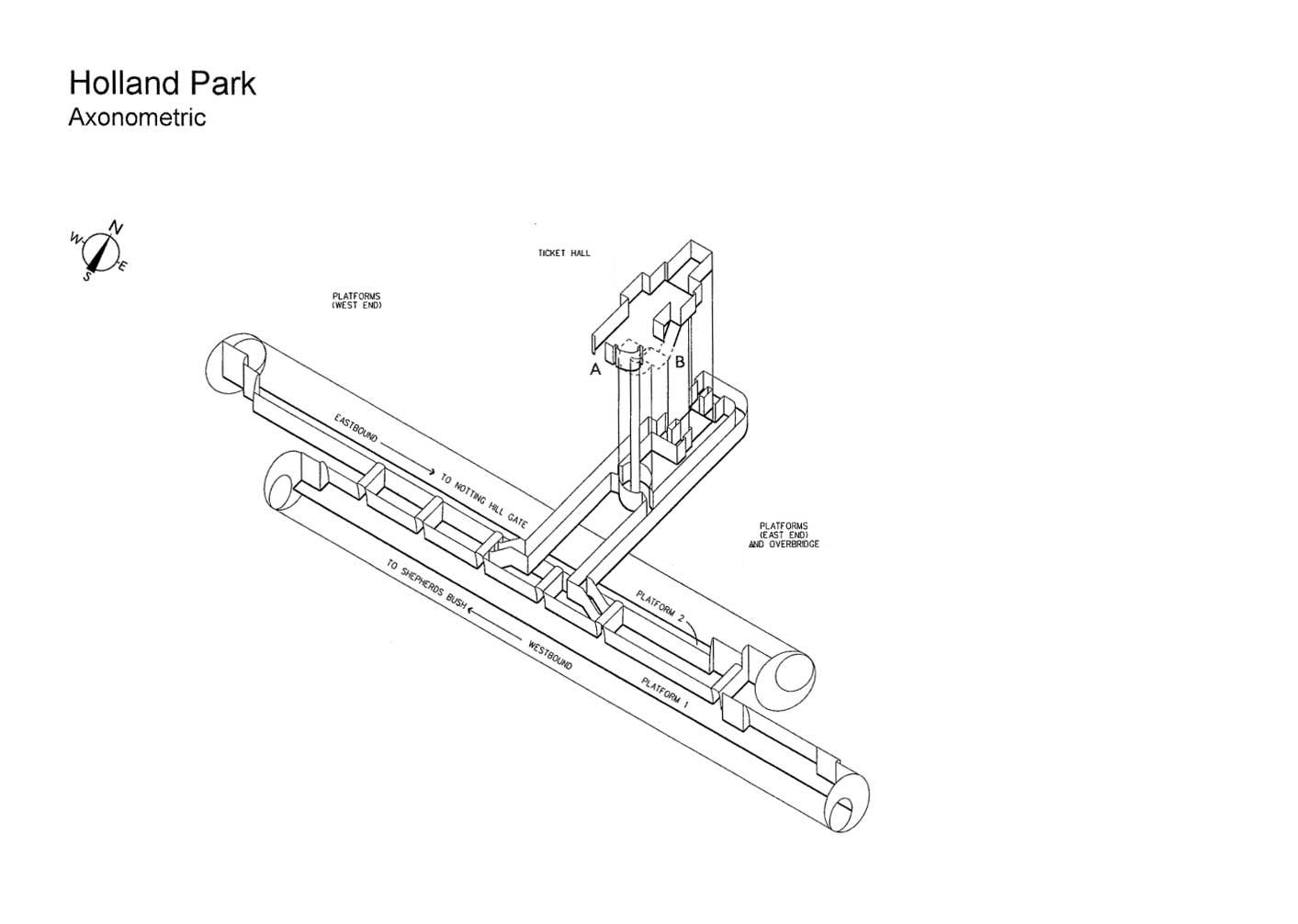
Holland Park

Holloway Road

Hounslow West

Hyde Park Corner

Kennington

Kentish Town

Kilburn Park

King’s Cross
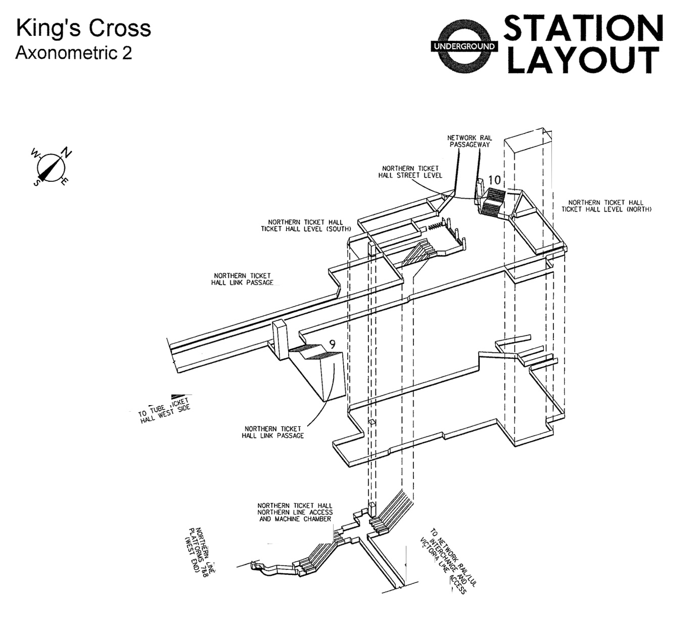
King’s Cross
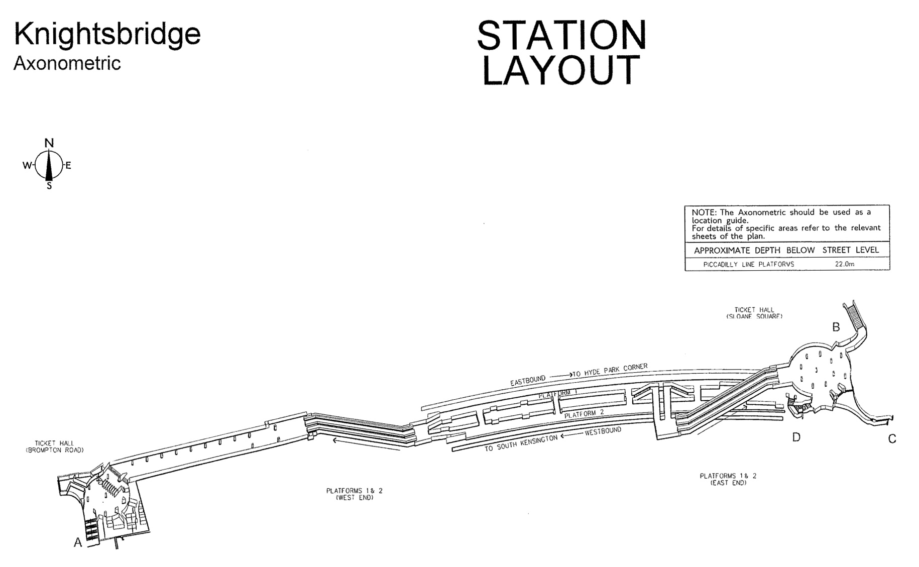
Knightsbridge

Lambeth North

Lancaster Gate

Leicester Square
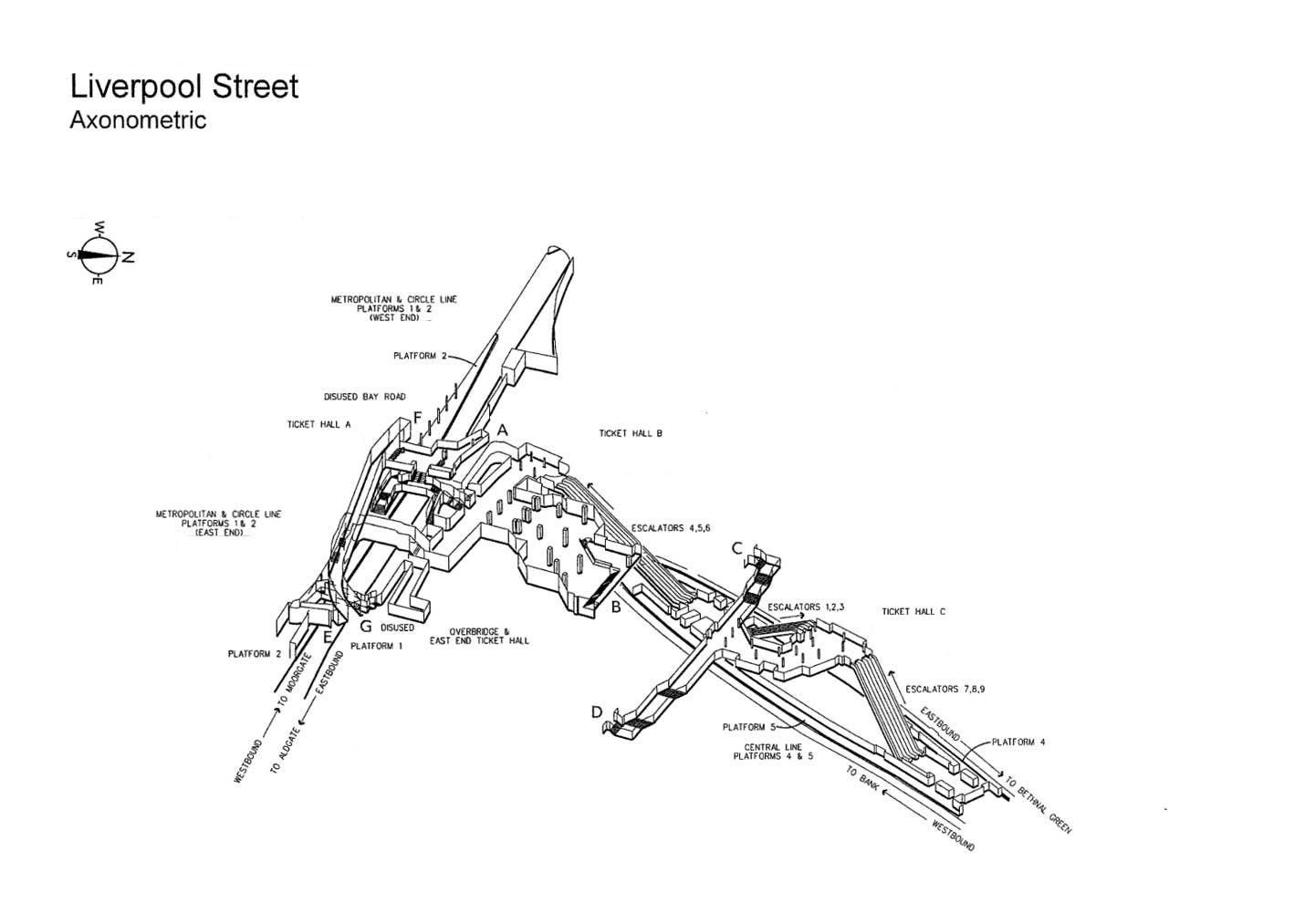
Liverpool Street
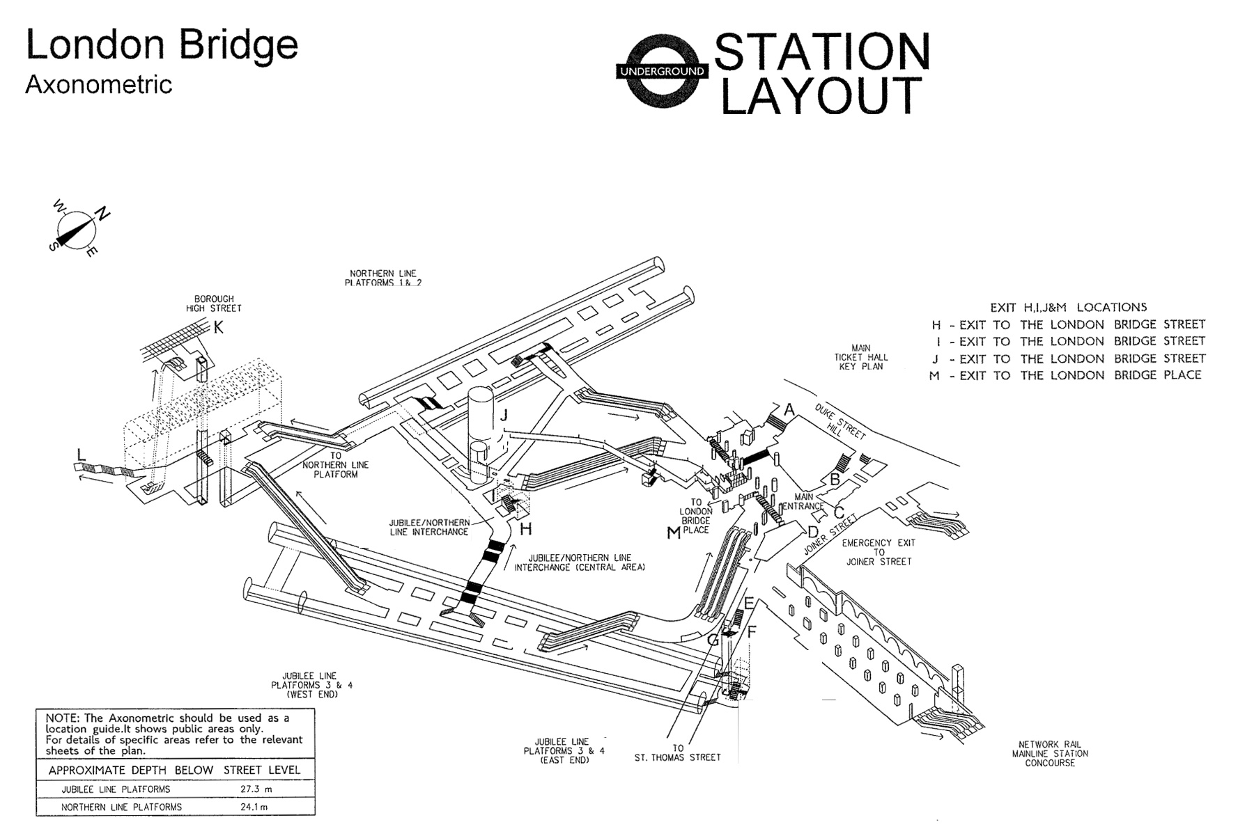
London Bridge
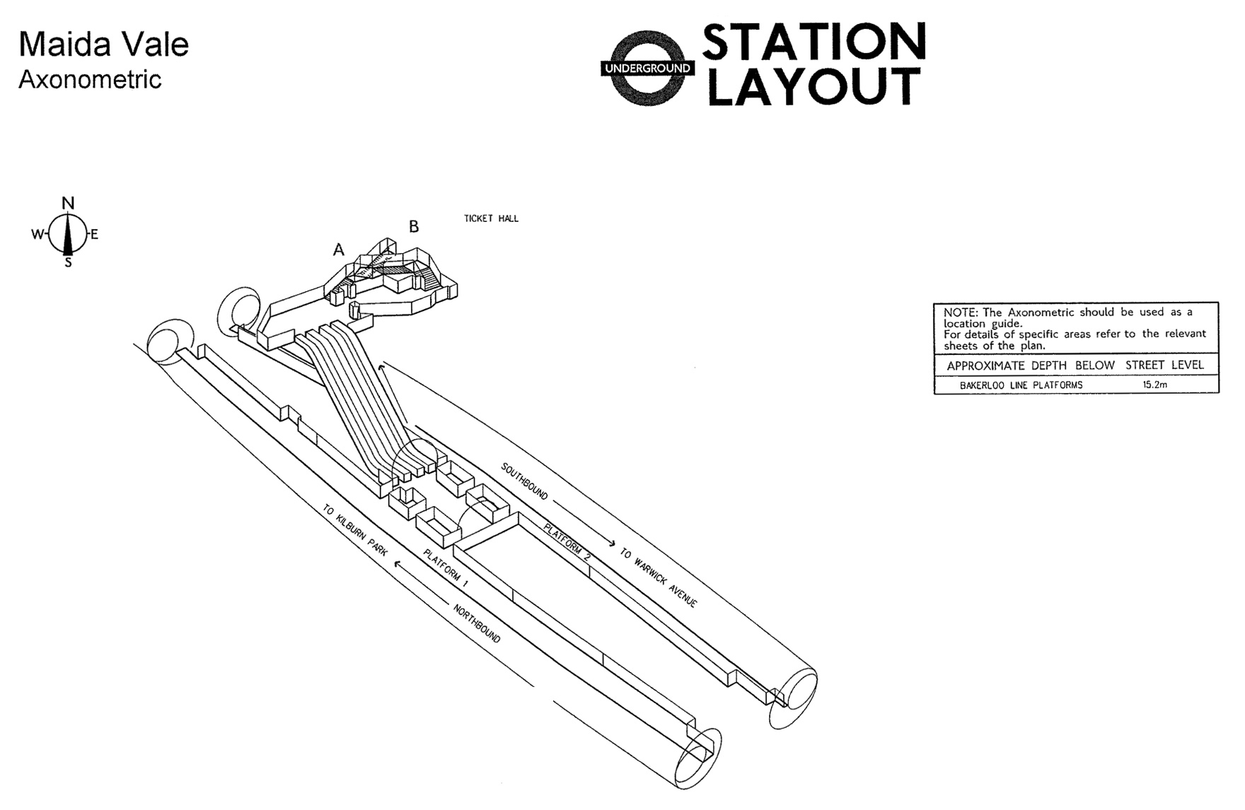
Maida Vale
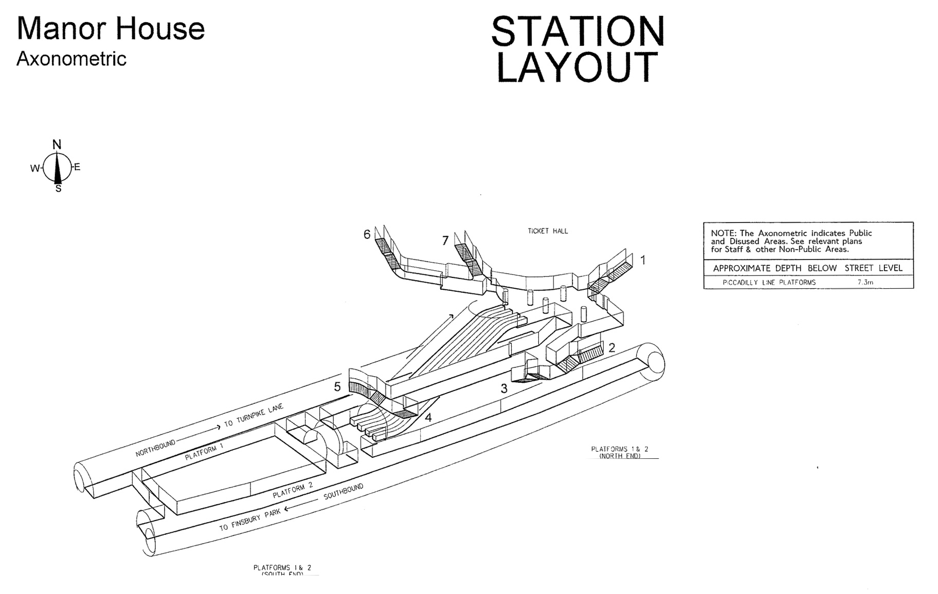
Manor House

Mansion House
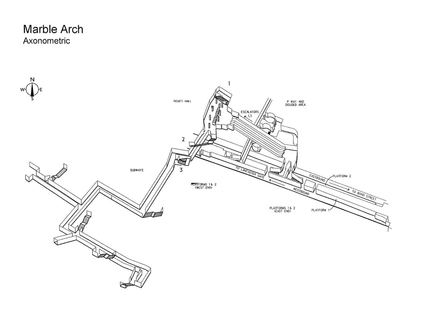
Marble Arch

Marylebone

Mile End

Moorgate
Stations H-M
Original reference files here.
Copyright
Copyright of the diagrams is owned by TfL. If you would like to re-use the information please contact TfL. Requests for re-use will be considered in accordance with the Re-use of Public Sector Information Regulations 2005 and, where the disclosed information is a dataset, section 11a of the Freedom of Information Act.


Strange – no Hammersmith.
No tunnels at Hammersmith.
No Mornington crescent – radio4 listeners will be distraught 🙂
I don’t see Baker Street?
Hobbs End?
Hobbs end is not a Tube Station.
Thank you very much for this service to map geeks everywhere.
No mornington crescent?
Wow these are absolutely fucking amazing! I could easily and enjoyably spend my life recreating these, all of these, in model form. I, my friend, salute you.